
Bishop Rock
Islet in the Atlantic Ocean, at the Isles of Scilly, England
The Bishop Rock (Cornish: Men an Epskop) is a skerry off the British coast in the northern Atlantic Ocean known for its lighthouse. It is in the westernmost part of the Isles of Scilly, an archipelago 45 kilometres (24 nautical miles) off the southwestern tip of the Cornish peninsula of Great Britain.
Nº Q866344 ★★
Uncommon · Places
Bishop Rock
Islet in the Atlantic Ocean, at the Isles of Scilly, England
The Bishop Rock (Cornish: Men an Epskop) is a skerry off the British coast in the northern Atlantic Ocean known for its lighthouse. It is in the westernmost part of the Isles of Scilly, an archipelago 45 kilometres (24 nautical miles) off the southwestern tip of the Cornish peninsula of Great Britain.
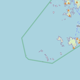
On the map


Last price
—
Floor price
—
7-day median
—
30-day sales
0
30-day range
—
In circulation
0
Price history
median
low – high
sales
No sales in this period
Show table
| Date | median | Low | High | sales |
|---|
Sales history
- Last sale
- —
- 30-day average
- —
- 30-day low
- —
- 30-day high
- —
- Sales 7d
- 0
- Sales 30d
- 0
No sales yet.
Anonymous sales: no buyer or seller shown. Figures count player-to-player sales only.
From Wikipedia
The Bishop Rock (Cornish: Men an Epskop) is a skerry off the British coast in the northern Atlantic Ocean known for its lighthouse. It is in the westernmost part of the Isles of Scilly, an archipelago 45 kilometres (24 nautical miles) off the southwestern tip of the Cornish peninsula of Great Britain. The Guinness Book of Records lists it as the world's smallest island with a building on it. The original iron lighthouse was begun in 1847 but was washed away before it could be completed. The present building was completed in 1858 and was first lit on 1 September that year. Before the installation of the helipad, visitors to the lighthouse would rappel from the base (with winches installed at the lamp level and at the base) to boats waiting away from the lighthouse. Bishop Rock is also at the eastern end of the North Atlantic shipping route used by ocean liners in the first half of the 20th century; the western end being the entrance to Lower New York Bay. This was the route that ocean liners took when competing for the transatlantic speed record, known as the Blue Riband.
Text: Wikipédia, CC BY-SA 4.0. · Image: Richard Knights (CC BY-SA 2.0) ·
Related cards

Créac'h Lighthouse
Lighthouse in Finistère, France
Nº Q1272235 ★★★

Bass Rock
Island in the east of Scotland
Nº Q151445 ★★

Bell Rock Lighthouse
Lighthouse off the coast of Angus, Scotland, UK
Nº Q2305375 ★★★

Machias Seal Island
Island disputed between the United States (Maine) and Canada (New Brunswick)
Nº Q477574 ★★

Farne Islands
Island group
Nº Q666887 ★★

St Mary's, Isles of Scilly
UK island of the Isles of Scilly
Nº Q1329355 ★★