
Dalsnibba
Mountain
Dalsnibba is a mountain in Stranda Municipality in Møre og Romsdal county, Norway. It is located at the end of the Geiranger valley, about 7 km (4 mi) south of the village of Geiranger and the Geirangerfjorden. The 2-square-kilometre (0.8 sq mi) lake Djupvatnet lies directly to the southeast of the mountain.
Nº Q1158087 ★★
Uncommon · Places
Dalsnibba
Mountain
Dalsnibba is a mountain in Stranda Municipality in Møre og Romsdal county, Norway. It is located at the end of the Geiranger valley, about 7 km (4 mi) south of the village of Geiranger and the Geirangerfjorden. The 2-square-kilometre (0.8 sq mi) lake Djupvatnet lies directly to the southeast of the mountain.
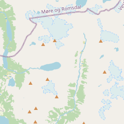
On the map



Last price
—
Floor price
—
7-day median
—
30-day sales
0
30-day range
—
In circulation
0
Price history
median
low – high
sales
No sales in this period
Show table
| Date | median | Low | High | sales |
|---|
Sales history
- Last sale
- —
- 30-day average
- —
- 30-day low
- —
- 30-day high
- —
- Sales 7d
- 0
- Sales 30d
- 0
No sales yet.
Anonymous sales: no buyer or seller shown. Figures count player-to-player sales only.
From Wikipedia
Dalsnibba is a mountain in Stranda Municipality in Møre og Romsdal county, Norway. It is located at the end of the Geiranger valley, about 7 km (4 mi) south of the village of Geiranger and the Geirangerfjorden. The 2-square-kilometre (0.8 sq mi) lake Djupvatnet lies directly to the southeast of the mountain. The mountain is located very near the county border with both Innlandet and Vestland counties, in the southeastern part of Møre og Romsdal county. Dalsnibba offers a good view and is therefore a popular tourist destination. Dalsnibba is often covered by snow even in the summer. The Norwegian County Road 63 passes along the south side of the mountain, and from that road, there is a private toll road called Nibbevegen, owned and operated by Geiranger Skysslag, that goes up to the summit of Dalsnibba, a drive of about 21 km (13 mi) from Geiranger. It was completed in 1939 but due to the Second World War its official opening was delayed until 19 July 1948. The road was tarmacked in 2013. The Geiranger – From Fjord to Summit running and cycling race begins in the village of Geiranger and ends on top of Dalsnibba.
Text: Wikipédia, CC BY-SA 4.0. · Image: Wikimedia Commons (Public domain) ·
Related cards

Geiranger
Village in Sunnmøre, Norway
Nº Q1019493 ★★★★

Hardangervidda
Mountain range
Nº Q1585051 ★★★★

Kjeragbolten
Boulder in Norway
Nº Q6419456 ★★

Røsvatnet
Lake in Hattfjelldal and Hemnes, Nordland, Norway
Nº Q1352298 ★★

Storsylen
Mountain in Trøndelag, Norway
Nº Q1370893 ★★★

Glittertind
Mountain
Nº Q397876 ★★