
Eastern Docklands
Neighborhood in Amsterdam, Netherlands
The Eastern Docklands (Dutch: Oostelijk Havengebied) is a neighborhood of Amsterdam, Netherlands, located between the IJ and the Nieuwe Vaart in the borough of Amsterdam-Oost. The harbor area was constructed in the late nineteenth century to allow for increasing trade with the Dutch East Indies; a new location was necessitated by the construction of the Amsterdam Centraal railway station, which replaced the old quays.
Nº Q3070648 ★★★
Rare · Places
Eastern Docklands
Neighborhood in Amsterdam, Netherlands
The Eastern Docklands (Dutch: Oostelijk Havengebied) is a neighborhood of Amsterdam, Netherlands, located between the IJ and the Nieuwe Vaart in the borough of Amsterdam-Oost. The harbor area was constructed in the late nineteenth century to allow for increasing trade with the Dutch East Indies; a new location was necessitated by the construction of the Amsterdam Centraal railway station, which replaced the old quays.
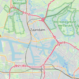
On the map
Last price
—
Floor price
—
7-day median
—
30-day sales
0
30-day range
—
In circulation
0
Price history
median
low – high
sales
No sales in this period
Show table
| Date | median | Low | High | sales |
|---|
Sales history
- Last sale
- —
- 30-day average
- —
- 30-day low
- —
- 30-day high
- —
- Sales 7d
- 0
- Sales 30d
- 0
No sales yet.
Anonymous sales: no buyer or seller shown. Figures count player-to-player sales only.
From Wikipedia
The Eastern Docklands (Dutch: Oostelijk Havengebied) is a neighborhood of Amsterdam, Netherlands, located between the IJ and the Nieuwe Vaart in the borough of Amsterdam-Oost. The harbor area was constructed in the late nineteenth century to allow for increasing trade with the Dutch East Indies; a new location was necessitated by the construction of the Amsterdam Centraal railway station, which replaced the old quays. East of the new station was a marshy area called De Rietlanden, with the Zeeburgerdijk (then called Sint Antoniesdijk), running via the Zeeburch, a fort, to the Zuiderzee. The neighborhood consists of the districts: KNSM Island, Java-eiland, Oostelijke Handelskade, Cruquiuseiland, Borneo-eiland and Sporenburg. The area, about 2/3 water and 1/3 land, consists of an extension of the Oostelijke Handelskade, east of the center of town, and four artificial "islands" (peninsulas), all of which were former industrial and harbor locations of the port of Amsterdam. In the early 2000s, after a large-scale reorganization, the city's biggest post-World War II building project, the Eastern Docklands was de-industrialized and became home to some 17,000 people living in some the highest population densities in the Netherlands.
Text: Wikipédia, CC BY-SA 4.0. · Image: Milliped (CC BY-SA 3.0) ·
Related cards
-

Oosterdokseiland
Island and neighborhood in Amsterdam, Netherlands
Nº Q2538727 ★★
Not listed
-

Oostpoort
Neighborhood in Amsterdam, Netherlands
Nº Q3119620 ★★
Not listed
-

Zeeheldenbuurt
Neighborhood in Amsterdam, Netherlands
Nº Q2189478 ★★
Not listed
-

Cruquiuseiland
Neighborhood in Amsterdam, Netherlands
Nº Q15212110 ★★
Not listed
-

Indische Buurt
Neighborhood in Amsterdam, Netherlands
Nº Q1661514 ★★★
Not listed
-

Zeedijk
Street in Amsterdam, the Netherlands
Nº Q2243755 ★
Not listed