
Fiordland
Geographic area of New Zealand
Fiordland (Māori: Te Rua-o-te-Moko, "The Pit of Tattooing", and also translated as "the Shadowlands") is a non-administrative geographical region of New Zealand in the south-western corner of the South Island, comprising the western third of Southland. Most of Fiordland is dominated by the steep sides of the snow-capped Southern Alps, deep lakes, and its steep, glacier-carved and now ocean-flooded western valleys.
Nº Q2266713 ★★
Uncommon · Places
Fiordland
Geographic area of New Zealand
Fiordland (Māori: Te Rua-o-te-Moko, "The Pit of Tattooing", and also translated as "the Shadowlands") is a non-administrative geographical region of New Zealand in the south-western corner of the South Island, comprising the western third of Southland. Most of Fiordland is dominated by the steep sides of the snow-capped Southern Alps, deep lakes, and its steep, glacier-carved and now ocean-flooded western valleys.
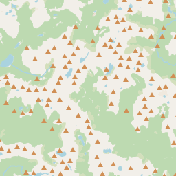
On the map

Last price
—
Floor price
—
7-day median
—
30-day sales
0
30-day range
—
In circulation
0
Price history
median
low – high
sales
No sales in this period
Show table
| Date | median | Low | High | sales |
|---|
Sales history
- Last sale
- —
- 30-day average
- —
- 30-day low
- —
- 30-day high
- —
- Sales 7d
- 0
- Sales 30d
- 0
No sales yet.
Anonymous sales: no buyer or seller shown. Figures count player-to-player sales only.
From Wikipedia
Fiordland (Māori: Te Rua-o-te-Moko, "The Pit of Tattooing", and also translated as "the Shadowlands") is a non-administrative geographical region of New Zealand in the south-western corner of the South Island, comprising the western third of Southland. Most of Fiordland is dominated by the steep sides of the snow-capped Southern Alps, deep lakes, and its steep, glacier-carved and now ocean-flooded western valleys. The name "Fiordland" derives from the New Zealand English spelling of the Scandinavian word for steep glacial valleys, "fjord". The geographic area of Fiordland is dominated by, and roughly coterminous with, Fiordland National Park, New Zealand's largest national park. Due to the often steep terrain and high amount of rainfall supporting dense vegetation, the interior of the Fiordland region is largely inaccessible. As a result, Fiordland was never subjected to notable logging operations, and even attempts at whaling, seal hunting, and mining were on a small scale and short-lived, partly also because of the challenging weather. Today, Fiordland contains by far the greatest extent of unmodified vegetation in New Zealand and significant populations of endemic plants and threatened animals, in some cases the only remaining wild populations. Fiordland features a number of fiords, which in this area are typically named sounds, reflecting the fact that sometimes fiords are considered to be a type of narrow sound. Of the twelve major fiords on Fiordland's west coast, Milford Sound / Piopiotahi is the most famous and the only one accessible by road. Doubtful Sound / Patea, which is much larger, is also a tourist destination, but is less accessible as it requires both a boat trip over Lake Manapouri and bus transfer over Wilmot Pass. Also situated within Fiordland are Browne Falls and Sutherland Falls, which rank among the tallest waterfalls in the world, and New Zealand's three deepest lakes, Lake...
Text: Wikipédia, CC BY-SA 4.0. · Image: Thorney¿? (CC BY-SA 3.0) ·
Related cards

Fiordland National Park
National park on South Island of New Zealand
Nº Q877719 ★

Geography of New Zealand
Overview of the geography of New Zealand
Nº Q1773900 ★★★

Fjard
Glacially formed, broad, shallow inlet
Nº Q9258947 ★

Southland Region
Region in southern New Zealand
Nº Q864971 ★

Invercargill
City in New Zealand's Southland region
Nº Q31805 ★★★

Lake Wakatipu
Lake in Otago Region, New Zealand
Nº Q127469 ★