
Foggy Bottom
Late 18th and 19th-century neighborhood in Washington, D.C.
Foggy Bottom is a neighborhood of Washington, D.C., United States, located in the city's northwest quadrant. It stretches west of the White House towards the Potomac River, north of the National Mall, east of Georgetown, south of the West End neighborhood and west of Downtown.
Nº Q2019662 ★★
Uncommon · Places
Foggy Bottom
Late 18th and 19th-century neighborhood in Washington, D.C.
Foggy Bottom is a neighborhood of Washington, D.C., United States, located in the city's northwest quadrant. It stretches west of the White House towards the Potomac River, north of the National Mall, east of Georgetown, south of the West End neighborhood and west of Downtown.
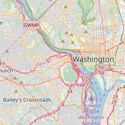
On the map
Last price
—
Floor price
—
7-day median
—
30-day sales
0
30-day range
—
In circulation
0
Price history
median
low – high
sales
No sales in this period
Show table
| Date | median | Low | High | sales |
|---|
Sales history
- Last sale
- —
- 30-day average
- —
- 30-day low
- —
- 30-day high
- —
- Sales 7d
- 0
- Sales 30d
- 0
No sales yet.
Anonymous sales: no buyer or seller shown. Figures count player-to-player sales only.
From Wikipedia
Foggy Bottom is a neighborhood of Washington, D.C., United States, located in the city's northwest quadrant. It stretches west of the White House towards the Potomac River, north of the National Mall, east of Georgetown, south of the West End neighborhood and west of Downtown. Foggy Bottom originated in a landholding planned as a town in the 1760s by Jacob Funk. Following the establishment of the District of Columbia in 1791, the neighborhood first emerged as a lightly settled area with both wealthy and middle class residents. The opening of the Chesapeake and Ohio Canal (C&O) in the 1830s, which provided access to coal, limestone, and other commodities, expanded Foggy Bottom's industrial capacity. By the mid-19th century, Foggy Bottom's western half became primarily a working class community composed of immigrants from Ireland, Germany, and elsewhere in Europe; many found work in its factories, which consisted of businesses including breweries, lime kilns, and a gasworks. Its black population, which had resided in Foggy Bottom since its inception, also expanded as freedmen migrated to Washington in the aftermath of the American Civil War and emancipation. Like elsewhere in Washington during its post-Civil War population boom, alley dwellings and shanties emerged in Foggy Bottom to house its poorest residents, many of whom were black laborers and families. Deindustrialization caused by the decline of the C&O Canal and Prohibition resulted in Foggy Bottom's historical working class residents migrating to the region's suburbs and newer neighborhoods during the first several decades of the 20th century. This development mostly excluded Foggy Bottom's black residents, who were significantly restricted in their choice of housing by the area's prevailing Jim Crow policies and racially restrictive housing covenants. Private developers, government agencies, and the George Washington University, which had moved to the neighborhood in 1912, demolished many of Foggy...
Text: Wikipédia, CC BY-SA 4.0. · Image: dbking (CC BY 2.0) ·
Related cards

Watergate complex
Group of buildings in Washington, D.C.
Nº Q1419538 ★★★

Georgetown (Washington, D.C.)
Neighborhood and historic district in Washington, D.C., United States
Nº Q1468648 ★★★

Chesapeake and Ohio Canal
Canal in Washington, D.C. and Maryland, United States
Nº Q1070564 ★★

History of Washington, D.C.
History of the capital city of the United States
Nº Q685093 ★

Washington Monument
Obelisk on the National Mall in Washington, D.C.
Nº Q178114 ★★★★

Forks, Washington
City in Clallam County, Washington, United States
Nº Q226013 ★★★