
Forssa
Town in the region of Kanta-Häme, Finland
Forssa is a town and municipality of Finland. It is located almost in the centre of a triangle defined by the three largest major cities in Finland (Helsinki, Turku and Tampere), in the Kanta-Häme region, and which is crossed by Highway 2 between Pori and Helsinki and Highway 10 between Turku and Hämeenlinna.
Nº Q829842 ★
Common · Places
Forssa
Town in the region of Kanta-Häme, Finland
Forssa is a town and municipality of Finland. It is located almost in the centre of a triangle defined by the three largest major cities in Finland (Helsinki, Turku and Tampere), in the Kanta-Häme region, and which is crossed by Highway 2 between Pori and Helsinki and Highway 10 between Turku and Hämeenlinna.
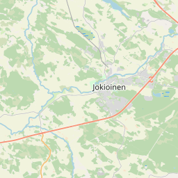
On the map

Last price
—
Floor price
—
7-day median
—
30-day sales
0
30-day range
—
In circulation
0
Price history
median
low – high
sales
No sales in this period
Show table
| Date | median | Low | High | sales |
|---|
Sales history
- Last sale
- —
- 30-day average
- —
- 30-day low
- —
- 30-day high
- —
- Sales 7d
- 0
- Sales 30d
- 0
No sales yet.
Anonymous sales: no buyer or seller shown. Figures count player-to-player sales only.
From Wikipedia
Forssa is a town and municipality of Finland. It is located almost in the centre of a triangle defined by the three largest major cities in Finland (Helsinki, Turku and Tampere), in the Kanta-Häme region, and which is crossed by Highway 2 between Pori and Helsinki and Highway 10 between Turku and Hämeenlinna. The town has a population of 16,307 (31 December 2025) and covers an area of 253.38 square kilometres (97.83 sq mi) of which 4.61 km2 (1.78 sq mi) is water. The population density is 65.53 inhabitants per square kilometre (169.7/sq mi). Only a little part of the surface area of Forssa is water, but the river Loimijoki forms an important element in the cityscape, with the city being located at its starting point. Other notable water areas in Forssa include the lake Kaukjärvi and the lake Koijärvi, known as the birthplace of the Green League. The municipality is unilingually Finnish. However, the name Forssa comes from the Swedish word "fors", meaning rapids. Forssa is the central locality of the Forssa sub-region. The city is bordered with Jokioinen to the west, Tammela to the east and south and Humppila and Urjala to the north. As well as Forssa, the Forssa sub-region includes Jokioinen, Tammela, Humppila and Ypäjä. Forssa is the smallest of the three cities in Kanta-Häme, with a population of about 16,500, and in terms of population Forssa is the 67th largest municipality in Finland. The population in Forssa has concentrated on the Forssa central conurbation in the southern part of the municipality, which also spreads over to the municipalities of Jokioinen and Tammela. The area of the former municipality of Koijärvi in the northern part of the city is a sparsely populated rural area. Forssa grew and developed in the 19th century when the textile industry...
Text: Wikipédia, CC BY-SA 4.0. · Image: Original uploader was Käyttäjä:Huussi. (CC BY-SA 3.0) ·
Related cards

Forshaga
Urban area in Forshaga Municipality, Sweden
Nº Q1303800 ★★★★

Satakunta
Region of Finland
Nº Q5709 ★★

Forsvik
Urban area in Karlsborg Municipality, Sweden
Nº Q759763 ★

Võru
Town and administrative centre of Võru County in south-eastern Estonia
Nº Q205271 ★★★

Urjala
Municipality in the region of Pirkanmaa in Finland
Nº Q636459 ★★

Salla
Municipality in the region of Lapland in Finland
Nº Q936067 ★★