
Freedom Trail
Historical walking trail in Boston, Massachusetts
The Freedom Trail is a 2.5-mile-long (4.0 km) path through Boston, Massachusetts, that passes by 16 locations significant to the history of the United States. It winds from Boston Common in downtown Boston to the Old North Church in the North End and the Bunker Hill Monument in Charlestown.
Nº Q49131 ★★
Uncommon · Places
Freedom Trail
Historical walking trail in Boston, Massachusetts
The Freedom Trail is a 2.5-mile-long (4.0 km) path through Boston, Massachusetts, that passes by 16 locations significant to the history of the United States. It winds from Boston Common in downtown Boston to the Old North Church in the North End and the Bunker Hill Monument in Charlestown.
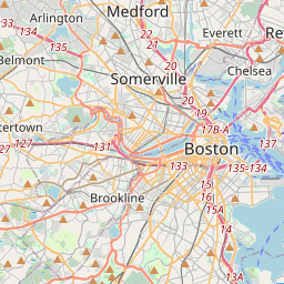
On the map
Last price
—
Floor price
—
7-day median
—
30-day sales
0
30-day range
—
In circulation
0
Price history
median
low – high
sales
No sales in this period
Show table
| Date | median | Low | High | sales |
|---|
Sales history
- Last sale
- —
- 30-day average
- —
- 30-day low
- —
- 30-day high
- —
- Sales 7d
- 0
- Sales 30d
- 0
No sales yet.
Anonymous sales: no buyer or seller shown. Figures count player-to-player sales only.
From Wikipedia
The Freedom Trail is a 2.5-mile-long (4.0 km) path through Boston, Massachusetts, that passes by 16 locations significant to the history of the United States. It winds from Boston Common in downtown Boston to the Old North Church in the North End and the Bunker Hill Monument in Charlestown. Stops along the trail include simple explanatory ground markers, graveyards, notable churches and buildings, and a historic naval frigate. Most of the sites are free or suggest donations, although the Old South Meeting House, the Old State House, and the Paul Revere House charge admission. The Freedom Trail is overseen by the City of Boston's Freedom Trail Commission and is supported in part by grants from various non-profit organizations and foundations, private philanthropy, and Boston National Historical Park. The Freedom Trail was conceived by journalist William Schofield in 1951, who suggested building a pedestrian trail to link important landmarks. Boston mayor John Hynes decided to put Schofield's idea into action. By 1953, 40,000 people were walking the trail annually. In 2026, an augmented reality tour called Relive 1776 was introduced along the Freedom Trail. The National Park Service operates a visitor center on the first floor of Faneuil Hall, where they offer tours, provide free maps of the Freedom Trail and other historic sites, and sell books about Boston and United States history. Some observers have noted the tendency of the Freedom Trail's narrative frame to omit certain historical locations, such as the sites of the Boston Tea Party and the Liberty Tree.
Text: Wikipédia, CC BY-SA 4.0. · Image: Ingfbruno (CC BY-SA 3.0) ·
Related cards

Boston Common
Public park in Boston, Massachusetts, USA
Nº Q49132 ★★

American Discovery Trail
Long-distance hiking and biking trail across the United States
Nº Q463893 ★

Liberty Tree
Historical elm tree
Nº Q1454303 ★★

Boot Monument
American Revolutionary War memorial
Nº Q4943827 ★

Mormon Trail
Migrant route from Nauvoo, Illinois, to Salt Lake City, Utah, USA
Nº Q379356 ★★

Charles River
River in Massachusetts, United States
Nº Q794927 ★★