
Gurez
Tehsil in Jammu and Kashmir, India
Gurez, or Gurais (Guráai in Shina language), is a tehsil in Bandipore District of Indian-administered Jammu and Kashmir. It contains most of the Gurez Valley, located in the high Himalayas to the north of the Kashmir Valley, separated from it by the great Himalayan range, and is situated about 86 kilometres (53 mi) from district headquarters Bandipore and 123 kilometres (76 mi) from Srinagar.
Nº Q4991441 ★
Common · Places
Gurez
Tehsil in Jammu and Kashmir, India
Gurez, or Gurais (Guráai in Shina language), is a tehsil in Bandipore District of Indian-administered Jammu and Kashmir. It contains most of the Gurez Valley, located in the high Himalayas to the north of the Kashmir Valley, separated from it by the great Himalayan range, and is situated about 86 kilometres (53 mi) from district headquarters Bandipore and 123 kilometres (76 mi) from Srinagar.
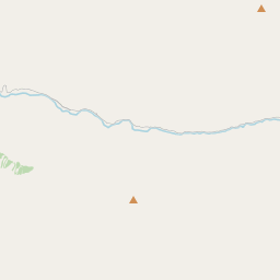
On the map

Last price
—
Floor price
—
7-day median
—
30-day sales
0
30-day range
—
In circulation
0
Price history
median
low – high
sales
No sales in this period
Show table
| Date | median | Low | High | sales |
|---|
Sales history
- Last sale
- —
- 30-day average
- —
- 30-day low
- —
- 30-day high
- —
- Sales 7d
- 0
- Sales 30d
- 0
No sales yet.
Anonymous sales: no buyer or seller shown. Figures count player-to-player sales only.
From Wikipedia
Gurez, or Gurais (Guráai in Shina language), is a tehsil in Bandipore District of Indian-administered Jammu and Kashmir. It contains most of the Gurez Valley, located in the high Himalayas to the north of the Kashmir Valley, separated from it by the great Himalayan range, and is situated about 86 kilometres (53 mi) from district headquarters Bandipore and 123 kilometres (76 mi) from Srinagar. A sub-valley of Gurez beyond Kamri came under Pakistani control after 1947, including Minimarg, and is today part of Astore District in Gilgit-Baltistan. Gurez lies near the Line of Control, which separates it from the Astore and Neelum Districts of Pakistan-administered Kashmir. The Burzil Pass in Astore leads from it into Astore Valley. At about 2,400 metres (8,000 ft) above sea level, the valley is surrounded by snow-capped mountains. The fauna include the Himalayan brown bear and the snow leopard. The Neelum River flows through the valley. Due to heavy snowfall and closure of Razdan Pass in winter, Gurez remains cut off for six months of the year from rest of Indian-administered Jammu and Kashmir. Dawar is the central township in the area. The population of the area is estimated to be about 40,000, and is scattered among fifteen villages. Majority of the inhabitants are ethnic Shins. They speak the Shina language and have the same dress styles and culture as their kinsmen in Pakistan-administered Gilgit-Baltistan.
Text: Wikipédia, CC BY-SA 4.0. · Image: Zahid samoon (CC BY 3.0) ·
Related cards

Kashmir division
Division in India
Nº Q3712126 ★

Gulmarg
Hill station and town in India
Nº Q1025272 ★★

Jammu division
Division in India
Nº Q2817363 ★★

Jammu and Kashmir (union territory)
Region administered by India as a union territory
Nº Q66278313 ★★★★

Kargil district
District of Ladakh, India
Nº Q1650798 ★★

Poonch district, India
District of Jammu and Kashmir, India
Nº Q2983134 ★