
Kalibangan
Town on the banks of the Ghaggar River in India
Kalibangan is a town located on the left or southern banks of the Ghaggar (Ghaggar-Hakra River) in Tehsil Pilibangān, between Suratgarh and Hanumangarh in Hanumangarh District, Rajasthan, India 205 km from Bikaner. It is also identified as being established in the triangle of land at the confluence of Drishadvati and Sarasvati Rivers.
Nº Q1722226 ★★
Uncommon · Places
Kalibangan
Town on the banks of the Ghaggar River in India
Kalibangan is a town located on the left or southern banks of the Ghaggar (Ghaggar-Hakra River) in Tehsil Pilibangān, between Suratgarh and Hanumangarh in Hanumangarh District, Rajasthan, India 205 km from Bikaner. It is also identified as being established in the triangle of land at the confluence of Drishadvati and Sarasvati Rivers.
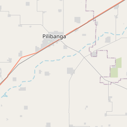
On the map
Last price
—
Floor price
—
7-day median
—
30-day sales
0
30-day range
—
In circulation
0
Price history
median
low – high
sales
No sales in this period
Show table
| Date | median | Low | High | sales |
|---|
Sales history
- Last sale
- —
- 30-day average
- —
- 30-day low
- —
- 30-day high
- —
- Sales 7d
- 0
- Sales 30d
- 0
No sales yet.
Anonymous sales: no buyer or seller shown. Figures count player-to-player sales only.
From Wikipedia
Kalibangan is a town located on the left or southern banks of the Ghaggar (Ghaggar-Hakra River) in Tehsil Pilibangān, between Suratgarh and Hanumangarh in Hanumangarh District, Rajasthan, India 205 km from Bikaner. It is also identified as being established in the triangle of land at the confluence of Drishadvati and Sarasvati Rivers. The prehistoric and pre-Mauryan character of the Indus Valley Civilization was first identified at this site by Luigi Tessitori. Kalibangan's excavation report was published in its entirety in 2003 by the Archaeological Survey of India, 34 years after the completion of excavations. The report concluded that Kalibangan was a major provincial capital of the Indus Valley Civilization. Kalibangan is distinguished by its unique fire altars and "world's earliest attested ploughed field". It is around 2900 BC that the region of Kalibangan developed into what can be considered a planned city. Kalibangan was first excavated under the Directorship of Braj Lal (ASI) between 1960-1961 to 1969-1970. Other excavation team members were Bal Thapar, M.D. Khare, K.M. Shrivastava, J.P. Joshi. and S.P. Jain.
Text: Wikipédia, CC BY-SA 4.0. · Image: Kk himalaya (Public domain) ·
Related cards

Srisailam
Census town in Nandyal district, Andhra Pradesh, India
Nº Q2269015 ★★★

Rajatarangini
Book by Kalhana
Nº Q1761336 ★★

Vrindavan
City in Mathura district, Uttar Pradesh, India
Nº Q688281 ★★★

Bharatas (Vedic tribe)
Tribe mentioned in the Regveda
Nº Q741734 ★

Arunachalesvara Temple
Temple in Tiruvannamalai
Nº Q3523924 ★★★

Roza Bal
Holy site in Srinagar, India
Nº Q1572188 ★★