
Kennebec River
River in Maine, United States
The Kennebec River (Abenaki: Kinəpékʷihtəkʷ) is a 170-mile-long (270 km) natural river within the U.S. state of Maine. It rises in Moosehead Lake in west-central Maine. The East and West Outlets join at Indian Pond and the river flows southward.
Nº Q1431323 ★★
Uncommon · Places
Kennebec River
River in Maine, United States
The Kennebec River (Abenaki: Kinəpékʷihtəkʷ) is a 170-mile-long (270 km) natural river within the U.S. state of Maine. It rises in Moosehead Lake in west-central Maine. The East and West Outlets join at Indian Pond and the river flows southward.
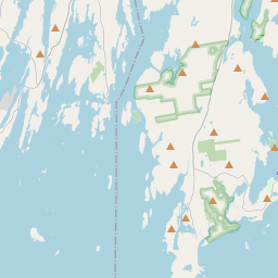
On the map
Last price
—
Floor price
—
7-day median
—
30-day sales
0
30-day range
—
In circulation
0
Price history
median
low – high
sales
No sales in this period
Show table
| Date | median | Low | High | sales |
|---|
Sales history
- Last sale
- —
- 30-day average
- —
- 30-day low
- —
- 30-day high
- —
- Sales 7d
- 0
- Sales 30d
- 0
No sales yet.
Anonymous sales: no buyer or seller shown. Figures count player-to-player sales only.
From Wikipedia
The Kennebec River (Abenaki: Kinəpékʷihtəkʷ) is a 170-mile-long (270 km) natural river within the U.S. state of Maine. It rises in Moosehead Lake in west-central Maine. The East and West Outlets join at Indian Pond and the river flows southward. Harris Station Dam, the largest hydroelectric dam in the state, was constructed near that confluence. The river is joined at The Forks by its tributary, the Dead River, also called the West Branch. It continues south past the towns of Madison and Skowhegan, the city of Waterville, the state capital Augusta, the city of Hallowell, and the city of Gardiner. At Richmond, it flows into Merrymeeting Bay, a 16-mile-long (26 km) freshwater tidal bay, into which also flow the Androscoggin River and five smaller rivers. The Kennebec runs past the shipbuilding center of Bath, and has its mouth at the Gulf of Maine in the Atlantic Ocean. The Southern Kennebec flows below the fall line and does not have rapids. As a consequence, ocean tides and saltwater fish species, such as the endangered Atlantic Sturgeon, can go upriver affecting the ecology as far north as Waterville, a small city located more than 35 miles inland. Tributaries of the Kennebec include the Carrabassett River, Sandy River, Sebasticook River, and Pleasant Pond (Cobbosseecontee Stream). Segments of the East Coast Greenway run along the Kennebec.
Text: Wikipédia, CC BY-SA 4.0. · Image: AlexiusHoratius (CC BY-SA 3.0) ·
Related cards

Kennebec County, Maine
County in Maine, United States
Nº Q497172 ★

Waterville, Maine
City in Maine, United States
Nº Q997170 ★★

Penobscot River
River in the U.S. state of Maine
Nº Q945954 ★

Moosehead Lake
Lake in Maine, United States
Nº Q2514433 ★★

Merrimack River
River in New Hampshire and Massachusetts, United States
Nº Q517787 ★

Augusta, Maine
Capital city of the U.S. state of Maine and county seat of Kennebec County
Nº Q28206 ★★★