
Khardung La
Mountain pass in Ladakh, India
Khardung La (Tibetan: མཁར་གདོང་ལ་, Wylie: mkhar gdong la, THL: khar dong la) or Khardung Pass (elevation 5,359 m (17,582 ft)), 40 km (25 mi) north of Leh city, is a mountain pass in the Leh district of the union territory of Ladakh in India. The pass is on the Ladakh Range and connects the Indus river valley and the Shyok river valley.
Nº Q866388 ★★
Uncommon · Places
Khardung La
Mountain pass in Ladakh, India
Khardung La (Tibetan: མཁར་གདོང་ལ་, Wylie: mkhar gdong la, THL: khar dong la) or Khardung Pass (elevation 5,359 m (17,582 ft)), 40 km (25 mi) north of Leh city, is a mountain pass in the Leh district of the union territory of Ladakh in India. The pass is on the Ladakh Range and connects the Indus river valley and the Shyok river valley.
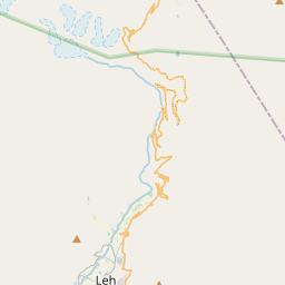
On the map


Last price
—
Floor price
—
7-day median
—
30-day sales
0
30-day range
—
In circulation
0
Price history
median
low – high
sales
No sales in this period
Show table
| Date | median | Low | High | sales |
|---|
Sales history
- Last sale
- —
- 30-day average
- —
- 30-day low
- —
- 30-day high
- —
- Sales 7d
- 0
- Sales 30d
- 0
No sales yet.
Anonymous sales: no buyer or seller shown. Figures count player-to-player sales only.
From Wikipedia
Khardung La (Tibetan: མཁར་གདོང་ལ་, Wylie: mkhar gdong la, THL: khar dong la) or Khardung Pass (elevation 5,359 m (17,582 ft)), 40 km (25 mi) north of Leh city, is a mountain pass in the Leh district of the union territory of Ladakh in India. The pass is on the Ladakh Range and connects the Indus river valley and the Shyok river valley. A strategically important motorable road from Leh in the south, built in 1976 by the Border Roads Organisation (BRO), connects to the Nubra Valley in north and also to the Siachen Glacier. The road is one of the world's highest motorable roads.
Text: Wikipédia, CC BY-SA 4.0. · Image: Vyacheslav Argenberg (CC BY 4.0) ·
Related cards

Karakoram Pass
Mountain pass in India
Nº Q784798 ★★

Rohtang Pass
Mountain pass
Nº Q633415 ★★

Zoji La
Mountain pass
Nº Q867075 ★

Khunjerab Pass
Mountain pass in Pakistan and China
Nº Q1137017 ★★

Chandra Taal
Lake situated in the Lahaul part of the Lahul and Spiti district of Himachal Pradesh (India)
Nº Q5071315 ★★

Kala Patthar
Landmark located on the south ridge of Pumori in the Nepalese Himalayas
Nº Q1511454 ★★