
Knüll
Low mountain range in Hesse in Germany
The Knüllgebirge (German pronunciation: [ˈknʏlɡəˌbɪʁɡə]) or simply Knüll ([knʏl] ) is a small mountain range in the northern part of Hesse, Germany, approximately 45 kilometres (28 mi) south of Kassel. Its highest peak is the Eisenberg, with an altitude of 635.5 metres (2,085 ft).
Nº Q446023 ★★★
Rare · Places
Knüll
Low mountain range in Hesse in Germany
The Knüllgebirge (German pronunciation: [ˈknʏlɡəˌbɪʁɡə]) or simply Knüll ([knʏl] ) is a small mountain range in the northern part of Hesse, Germany, approximately 45 kilometres (28 mi) south of Kassel. Its highest peak is the Eisenberg, with an altitude of 635.5 metres (2,085 ft).
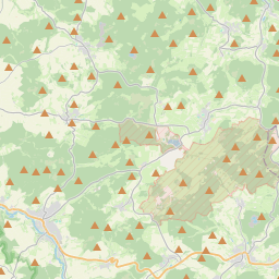
On the map
Last price
—
Floor price
—
7-day median
—
30-day sales
0
30-day range
—
In circulation
0
Price history
median
low – high
sales
No sales in this period
Show table
| Date | median | Low | High | sales |
|---|
Sales history
- Last sale
- —
- 30-day average
- —
- 30-day low
- —
- 30-day high
- —
- Sales 7d
- 0
- Sales 30d
- 0
No sales yet.
Anonymous sales: no buyer or seller shown. Figures count player-to-player sales only.
From Wikipedia
The Knüllgebirge (German pronunciation: [ˈknʏlɡəˌbɪʁɡə]) or simply Knüll ([knʏl] ) is a small mountain range in the northern part of Hesse, Germany, approximately 45 kilometres (28 mi) south of Kassel. Its highest peak is the Eisenberg, with an altitude of 635.5 metres (2,085 ft). The area is heavily forested and has a low population density compared to neighbouring regions. The principal town of the region is Schwarzenborn, with a population of 1158 (2006), which is the site of German army Jägerregiment 1 headquarters.
Text: Wikipédia, CC BY-SA 4.0. · Image: Elop (CC BY-SA 3.0) ·
Related cards

Bückeberg
Highest elevation of the mountain range Bückeberge in the Calenberger Bergland, Lower Saxony, Germany
Nº Q1020424 ★★

Wasserkuppe
Highest mountain of the Rhön Mountains in Hesse, Germany
Nº Q247726 ★★★★

Donnersberg
Mountain
Nº Q22547 ★★★

Schneeberg (Alps)
Massif in Austria
Nº Q143330 ★★★★

Rothaar Mountains
Mountain range in North Rhine-Westphalia and Hesse, Germany
Nº Q4219 ★★★★

Bad Hersfeld
Spa town and district seat of the Hersfeld-Rotenburg district in northeastern Hesse, Germany
Nº Q16145 ★★★★