
Lakshadweep
Union territory of India
Lakshadweep is a union territory of India. It is an archipelago of 36 islands divided into three island subgroups: the Amindivi Islands in the north, the Laccadive Islands (separated from Amindivi roughly by the 11th parallel north), and the atoll of Minicoy to the south of the Nine Degree Channel.
Nº Q26927 ★★★
Rare · Places
Lakshadweep
Union territory of India
Lakshadweep is a union territory of India. It is an archipelago of 36 islands divided into three island subgroups: the Amindivi Islands in the north, the Laccadive Islands (separated from Amindivi roughly by the 11th parallel north), and the atoll of Minicoy to the south of the Nine Degree Channel.
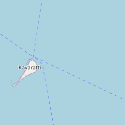
On the map
Last price
—
Floor price
—
7-day median
—
30-day sales
0
30-day range
—
In circulation
0
Price history
median
low – high
sales
No sales in this period
Show table
| Date | median | Low | High | sales |
|---|
Sales history
- Last sale
- —
- 30-day average
- —
- 30-day low
- —
- 30-day high
- —
- Sales 7d
- 0
- Sales 30d
- 0
No sales yet.
Anonymous sales: no buyer or seller shown. Figures count player-to-player sales only.
From Wikipedia
Lakshadweep is a union territory of India. It is an archipelago of 36 islands divided into three island subgroups: the Amindivi Islands in the north, the Laccadive Islands (separated from Amindivi roughly by the 11th parallel north), and the atoll of Minicoy to the south of the Nine Degree Channel. The islands are located between the Arabian Sea to the west and the Laccadive Sea to the east, about 220–440 km (140–270 mi) off the Malabar Coast of mainland India. The islands occupy a total land area of approximately 32.62 km2 (12.59 sq mi) with a population of 64,473 as per the 2011 census, spread across the ten inhabited islands. There is a 132 km (82 mi) long coastline with a lagoon area of 4,200 km2 (1,600 sq mi), territorial waters of 20,000 km2 (7,700 sq mi) and an exclusive economic zone of 400,000 km2 (150,000 sq mi). Lakshadweep is the northernmost island group of the exposed undersea mountain range, the Chagos-Lakshadweep Ridge. The entire union territory is administered as a single district, with Kavaratti as its capital. Archaeological evidence from Kalpeni indicates human settlement in the region from at least 1500 BCE with early references to the islands in the Buddhist Jataka tales from the 3rd century BCE and the Tamil Sangam literature Patiṟṟuppattu. The region was controlled by the Cheras in the Sangam period (3rd century BCE to 3rd century CE) and later by the Pallavas. Islam is presumed to have been brought to the islands in the 7th century with the arrival of Muslims. In the 11th century CE, the region was under the influence of the Chola kingdom and formed a part of the trade route that connected the Middle East with South Asia. It came under the influence of the Portuguese briefly in the late...
Text: Wikipédia, CC BY-SA 4.0. · Image: The.chhayachitrakar (CC BY-SA 4.0) ·
Related cards

Laccadive Sea
Sea
Nº Q544914 ★★

Minicoy
Atoll in India
Nº Q162448 ★

Geography of India
Overview of the geography of India
Nº Q838671 ★★★

Kerala
Indian state
Nº Q1186 ★★★★★

Gulf of Mannar
Gulf of the Indian Ocean between India and Sri Lanka
Nº Q622811 ★

Southern Zonal Council
Zonal council in India
Nº Q25344814 ★★