
Licancabur
Stratovolcano on the border between Bolivia and Chile
Licancabur (Spanish pronunciation: [likaŋkaˈβuɾ]) is a prominent, 5,916-metre-high (19,409 ft) stratovolcano on the Bolivia–Chile border in the Central Volcanic Zone of the Andes. It is capped by a 400–500-metre-wide (1,300–1,600 ft) summit crater which contains Licancabur Lake, a crater lake that is among the highest lakes in the world.
Nº Q422713 ★★★
Rare · Places
Licancabur
Stratovolcano on the border between Bolivia and Chile
Licancabur (Spanish pronunciation: [likaŋkaˈβuɾ]) is a prominent, 5,916-metre-high (19,409 ft) stratovolcano on the Bolivia–Chile border in the Central Volcanic Zone of the Andes. It is capped by a 400–500-metre-wide (1,300–1,600 ft) summit crater which contains Licancabur Lake, a crater lake that is among the highest lakes in the world.
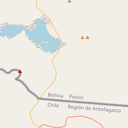
On the map
Last price
—
Floor price
—
7-day median
—
30-day sales
0
30-day range
—
In circulation
0
Price history
median
low – high
sales
No sales in this period
Show table
| Date | median | Low | High | sales |
|---|
Sales history
- Last sale
- —
- 30-day average
- —
- 30-day low
- —
- 30-day high
- —
- Sales 7d
- 0
- Sales 30d
- 0
No sales yet.
Anonymous sales: no buyer or seller shown. Figures count player-to-player sales only.
From Wikipedia
Licancabur (Spanish pronunciation: [likaŋkaˈβuɾ]) is a prominent, 5,916-metre-high (19,409 ft) stratovolcano on the Bolivia–Chile border in the Central Volcanic Zone of the Andes. It is capped by a 400–500-metre-wide (1,300–1,600 ft) summit crater which contains Licancabur Lake, a crater lake that is among the highest lakes in the world. There are no glaciers owing to the arid climate. Numerous plants and animal species live on the mountain. The volcanoes Sairecabur and Juriques are north and east of Licancabur, respectively. Licancabur formed on top of ignimbrites produced by other volcanoes, and has been active during the Holocene. Three stages of lava flows emanated from the edifice and have a young appearance. Although no historical eruptions of the volcano are known, lava flows extending into Laguna Verde have been dated to 13,240±100 years before present, and there may be residual heat in the mountain. The volcano has primarily erupted andesite, with small amounts of dacite and basaltic andesite. Several archaeological sites have been found on the mountain, on both its summit and northeastern foot. They are thought to have been constructed by the Inca or Atacama people for religious and cultural ceremonies and are among the most important in the region. The mountain is the subject of myths in which it is viewed as the husband of another mountain, a hiding place used by the Inca, or the burial of an Inca king.
Text: Wikipédia, CC BY-SA 4.0. · Image: NASA (Public domain) ·
Related cards

Republic of Mahabad
1946 unrecognised Kurdish state in Iran
Nº Q332232 ★★★

Greater Poland
Historical region of Poland
Nº Q211371 ★★★

Lidzbark Warmiński
City and urban gmina of Poland
Nº Q751123 ★★★

Gunung Padang
Sundanese archaeological site
Nº Q3120910 ★★★

Mississippi River System
Drainage basin of the Mississippi River
Nº Q2887546 ★★★

Contra Costa County, California
County in California, United States
Nº Q108058 ★★★