
Lubya
Village in Tiberias, Mandatory Palestine
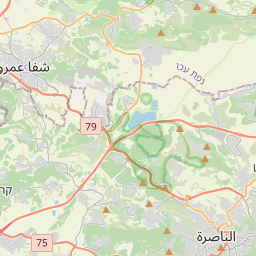
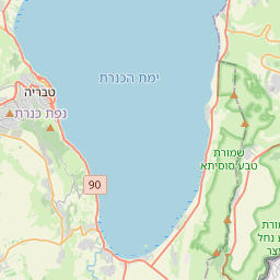
Lubya (Arabic: لوبيا "bean"), sometimes referred to as Lubia, Lubieh and Loubieh, was a Palestinian Arab town located ten kilometers west of Tiberias that was captured, ethnically cleansed, and destroyed by Israel during the 1948 Arab-Israeli War where its residents were forcefully evacuated and became refugees. Nearby villages included Nimrin to the north, Hittin to the northwest, and al-Shajara to the south; Each of those villages were also ethnically cleansed.
Nº Q2920974 ★★★
Rare · Places
Lubya
Village in Tiberias, Mandatory Palestine
Lubya (Arabic: لوبيا "bean"), sometimes referred to as Lubia, Lubieh and Loubieh, was a Palestinian Arab town located ten kilometers west of Tiberias that was captured, ethnically cleansed, and destroyed by Israel during the 1948 Arab-Israeli War where its residents were forcefully evacuated and became refugees. Nearby villages included Nimrin to the north, Hittin to the northwest, and al-Shajara to the south; Each of those villages were also ethnically cleansed.
On the map
Last price
—
Floor price
—
7-day median
—
30-day sales
0
30-day range
—
In circulation
0
Price history
median
low – high
sales
No sales in this period
Show table
| Date | median | Low | High | sales |
|---|
Sales history
- Last sale
- —
- 30-day average
- —
- 30-day low
- —
- 30-day high
- —
- Sales 7d
- 0
- Sales 30d
- 0
No sales yet.
Anonymous sales: no buyer or seller shown. Figures count player-to-player sales only.
From Wikipedia
Lubya (Arabic: لوبيا "bean"), sometimes referred to as Lubia, Lubieh and Loubieh, was a Palestinian Arab town located ten kilometers west of Tiberias that was captured, ethnically cleansed, and destroyed by Israel during the 1948 Arab-Israeli War where its residents were forcefully evacuated and became refugees. Nearby villages included Nimrin to the north, Hittin to the northwest, and al-Shajara to the south; Each of those villages were also ethnically cleansed. Lubya had a total land area of 39,629 dunams (3,963ha), of which 83% was Palestinian-owned and the remainder public property. Most of its cultivable land was planted with cereals while only 1,500 dunams (150 ha) were planted with olive groves. The village's built-up area was 210 dunams (21 ha).
Text: Wikipédia, CC BY-SA 4.0. · Image: Hanay (CC BY-SA 3.0) ·
Related cards

Nabi Rubin
Village in mandatory Palestine
Nº Q2911822 ★★★★★

Hittin
Historic Palestinian village, the site of the Battle of Hattin in 1187, replaced in 1949–1950 by two Jewish Israeli villages
Nº Q1246960 ★★

Qalunya
Village in Jerusalem, Mandatory Palestine
Nº Q2898847 ★★★

Tiberias
City in Galilee, Israel
Nº Q151920 ★★★

Beit Sira
Village council in Ramallah and al-Bireh Governorate
Nº Q2777855 ★★★

1948 Palestinian expulsion and flight
Ethnic cleansing, expulsion, and flight of Palestinians during the 1948 Palestine war
Nº Q13220089 ★★★★