
Menai Strait
Strait in the Wales, between Anglesey and Gwynedd
The Menai Strait (Welsh: Afon Menai, lit. 'River Menai') is a strait which separates the island of Anglesey from Gwynedd, on the mainland of Wales. It is situated between Caernarfon Bay in the south-west and Conwy Bay in the north-east, which are both inlets of the Irish Sea.
Nº Q922298 ★
Common · Places
Menai Strait
Strait in the Wales, between Anglesey and Gwynedd
The Menai Strait (Welsh: Afon Menai, lit. 'River Menai') is a strait which separates the island of Anglesey from Gwynedd, on the mainland of Wales. It is situated between Caernarfon Bay in the south-west and Conwy Bay in the north-east, which are both inlets of the Irish Sea.
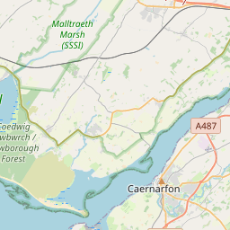
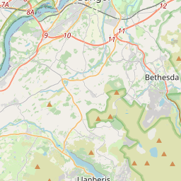
On the map
Last price
—
Floor price
—
7-day median
—
30-day sales
0
30-day range
—
In circulation
0
Price history
median
low – high
sales
No sales in this period
Show table
| Date | median | Low | High | sales |
|---|
Sales history
- Last sale
- —
- 30-day average
- —
- 30-day low
- —
- 30-day high
- —
- Sales 7d
- 0
- Sales 30d
- 0
No sales yet.
Anonymous sales: no buyer or seller shown. Figures count player-to-player sales only.
From Wikipedia
The Menai Strait (Welsh: Afon Menai, lit. 'River Menai') is a strait which separates the island of Anglesey from Gwynedd, on the mainland of Wales. It is situated between Caernarfon Bay in the south-west and Conwy Bay in the north-east, which are both inlets of the Irish Sea. The strait is about 16 mi (25 km) long and varies in width from 400 metres (1,300 ft) between Fort Belan and Abermenai Point to 4.7 miles (7.5 km) between Puffin Island (Ynys Seiriol) and Penmaenmawr. It contains several islands, including Church Island (Ynys Tysilio), on which is located St Tysilio's Church. The strait is bridged by the Menai Suspension Bridge (Pont Grog y Borth), which was completed in 1826 to a design by Thomas Telford and carries the A5 road, and the Britannia Bridge (Pont Britannia) a truss arch bridge which carries the North Wales Main Line and the A55 road; it is an adaptation of a tubular railway bridge completed in 1850 to a design by Robert Stephenson, which was severely damaged by a fire in 1970. The differential tides at the two ends of the strait cause very strong currents which create dangerous conditions. One of the most hazardous areas is the Swellies (Pwll Ceris), between the two bridges, where rocks near the surface cause over-falls and local whirlpools. This was the site of the loss of the training ship HMS Conway in 1953. Entering the strait at the Caernarfon end is also hazardous because of the frequently shifting sand banks that make up Caernarfon bar.
Text: Wikipédia, CC BY-SA 4.0. · Image: Bencherlite (CC BY-SA 3.0) ·
Related cards

Gwynedd
Principal area in north-west Wales
Nº Q109128 ★★★

Caernarfon
Town in Gwynedd, Wales
Nº Q428829 ★★★

Anglesey
Island in north-west Wales, UK
Nº Q168159 ★★★

Britannia Bridge
Bridge over the Menai Strait
Nº Q918066 ★★

Plas Newydd (Anglesey)
House in Anglesey, Wales
Nº Q7201721 ★★

Llanfairpwllgwyngyll
Village in Anglesey, Wales, United Kingdom
Nº Q322 ★★★★