
Mount Arvon
Mountain
Mount Arvon ( ARR-vahn) at 1,979 feet (603 m), is either the highest or second-highest natural point in the U.S. state of Michigan. Located in L'Anse Township, Baraga County, Mount Arvon is part of the Huron Mountains. It rises about eight miles (13 km) south of Lake Superior (elevation 591 feet [180 m]).
Nº Q1164979 ★★
Uncommon · Places
Mount Arvon
Mountain
Mount Arvon ( ARR-vahn) at 1,979 feet (603 m), is either the highest or second-highest natural point in the U.S. state of Michigan. Located in L'Anse Township, Baraga County, Mount Arvon is part of the Huron Mountains. It rises about eight miles (13 km) south of Lake Superior (elevation 591 feet [180 m]).
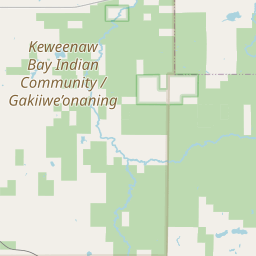
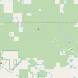
On the map

Last price
—
Floor price
—
7-day median
—
30-day sales
0
30-day range
—
In circulation
0
Price history
median
low – high
sales
No sales in this period
Show table
| Date | median | Low | High | sales |
|---|
Sales history
- Last sale
- —
- 30-day average
- —
- 30-day low
- —
- 30-day high
- —
- Sales 7d
- 0
- Sales 30d
- 0
No sales yet.
Anonymous sales: no buyer or seller shown. Figures count player-to-player sales only.
From Wikipedia
Mount Arvon ( ARR-vahn) at 1,979 feet (603 m), is either the highest or second-highest natural point in the U.S. state of Michigan. Located in L'Anse Township, Baraga County, Mount Arvon is part of the Huron Mountains. It rises about eight miles (13 km) south of Lake Superior (elevation 591 feet [180 m]). On the list of highest natural points in each U.S. state, Mount Arvon ranks 38th. It is the highest natural point in the East North Central states. Mount Arvon is a few miles from Mount Curwood, which for years had been designated as Michigan's highest spot until a resurvey in 1982 with modern technology determined that Mount Arvon was 1 foot (0.30 m) taller than Mount Curwood. Mount Arvon is about 12 miles (19 km) east of L'Anse, although it is about a 26-mile (42 km) drive from the village; much of it lies on winding logging roads. The soils of Mount Arvon are classic podzols which have developed on sandy loam glacial till locally overlain with a loamy or silty mantle. The Munising sandy loam-Michigamme silt loam complex is dominant. The property is owned by the MeadWestvaco paper company but public access is allowed. In 2018, the National Oceanic and Atmospheric Administration reported that the highest surface elevation in Michigan was the top of the Tilden Mine waste pile in Marquette County near Ishpeming. At the time, the top of the pile was at slightly above 2,000 feet (610 m), more than 20 feet (6.1 m) higher than the summit of Mount Arvon. More recent surveys in 2025 of both peaks determined that Mount Arvon lies 0.4 feet (0.12 m) lower than Mount Curwood.
Text: Wikipédia, CC BY-SA 4.0. · Image: Yinan Chen (Public Domain) ·
Related cards

Mount Avrin
The highest peak of West Azerbaijan Province, Iran
Nº Q5956354 ★★★

Granite Peak (Montana)
Mountain in Montana, United States of America
Nº Q599777 ★★

Avroman
Mountainous region located within the provinces of Kurdistan and Kermanshah in western Iran and in north-eastern Iraq within Iraq's Kurdistan Region
Nº Q1585478 ★

Black Elk Peak
Tallest mountain in the US state of South Dakota, and the tallest mountain in the United States east of the Rocky Mountains
Nº Q1585737 ★★

Katahdin
Highest mountain in the US state of Maine
Nº Q1858056 ★★★

Upper Peninsula of Michigan
Northern major peninsula of Michigan, United States of America
Nº Q1338 ★★★