
Mount Bandai
Mountain in Fukushima Prefecture, Japan
Mount Bandai (磐梯山, Bandai-san) is a stratovolcano located in Inawashiro-town, Bandai-town, and Kitashiobara village, in Yama-Gun, Fukushima prefecture. It is an active stratovolcano located to the north of Lake Inawashiro. Mount Bandai, including the Bandai heights, belongs to the Bandai-Asahi National Park.
Nº Q714605 ★★★★
Super Rare · Places
Mount Bandai
Mountain in Fukushima Prefecture, Japan
Mount Bandai (磐梯山, Bandai-san) is a stratovolcano located in Inawashiro-town, Bandai-town, and Kitashiobara village, in Yama-Gun, Fukushima prefecture. It is an active stratovolcano located to the north of Lake Inawashiro. Mount Bandai, including the Bandai heights, belongs to the Bandai-Asahi National Park.
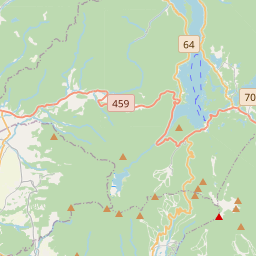
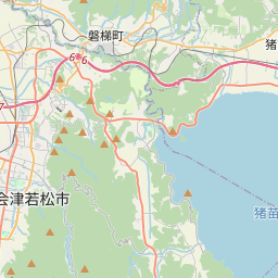
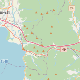
On the map

Last price
—
Floor price
—
7-day median
—
30-day sales
0
30-day range
—
In circulation
0
Price history
median
low – high
sales
No sales in this period
Show table
| Date | median | Low | High | sales |
|---|
Sales history
- Last sale
- —
- 30-day average
- —
- 30-day low
- —
- 30-day high
- —
- Sales 7d
- 0
- Sales 30d
- 0
No sales yet.
Anonymous sales: no buyer or seller shown. Figures count player-to-player sales only.
From Wikipedia
Mount Bandai (磐梯山, Bandai-san) is a stratovolcano located in Inawashiro-town, Bandai-town, and Kitashiobara village, in Yama-Gun, Fukushima prefecture. It is an active stratovolcano located to the north of Lake Inawashiro. Mount Bandai, including the Bandai heights, belongs to the Bandai-Asahi National Park. The altitude of the triangulation station "Bandai", installed in 1904, had been employed as the official altitude of Mount Bandai. However, after the station disappeared due to erosion, it was re-measured in October 2010 and now is 1,816.29 m (5,959.0 ft). The name "Mount Bandai" is used to refer to the main peak "Bandai", along with several other peaks including Akahani at 1,430 m (4,690 ft) and Kushigamine at 1,636 m (5,367 ft), created during the 1888 eruption of Mount Bandai. Mount Bandai was originally called "Iwahashi-yama" which means "a rock ladder to the sky". It is now sometimes called "Aizu Fuji" and "Aizu Bandai". The south foot is called Omotebandai and the north foot is called Urabandai. When seen from Omotebandai, the mountain looks tidy and mostly conical in shape, but when viewed from Urabandai the mountain shows a wild shape with jagged cliffs and exposed bedrock, due to its collapse. It is one of the 100 famous mountains of Japan. In 2007, the mountain was selected as one of the top 100 geographic landmarks in Japan. Additionally, in 2011 the mountain was certified as a geopark of Japan.
Text: Wikipédia, CC BY-SA 4.0. · Image: Σ64 (CC BY 3.0) ·
Related cards

1888 eruption of Mount Bandai
1888 volcanic eruption in present-day Bandai, Fukushima Prefecture, Japan
Nº Q3591485 ★★★

Goshiki-numa
Lake in Kitashiobara, Japan
Nº Q3214907 ★★★

Mount Azuma-kofuji
Mountain in Fukushima Prefecture, Japan
Nº Q718441 ★★

Bandai, Fukushima
Town in Yama district, Fukushima prefecture, Japan
Nº Q143208 ★★

Mount Nantai
Mountain in Tochigi Prefecture, Japan
Nº Q1964765 ★★★

Mount Iizuna
Mountain in Japan
Nº Q11666652 ★★