
Mount Garibaldi
Mountain in British Columbia, Canada
Mount Garibaldi (Squamish: Nch'ḵay̓, pronounced [n̩.ʧʼqɛˀj̰]) is a dormant stratovolcano in the Garibaldi Ranges of the Pacific Ranges in southwestern British Columbia, Canada. It has a maximum elevation of 2,678 metres (8,786 feet) and rises above the surrounding landscape on the east side of the Cheakamus River in New Westminster Land District.
Nº Q183027 ★
Common · Places
Mount Garibaldi
Mountain in British Columbia, Canada
Mount Garibaldi (Squamish: Nch'ḵay̓, pronounced [n̩.ʧʼqɛˀj̰]) is a dormant stratovolcano in the Garibaldi Ranges of the Pacific Ranges in southwestern British Columbia, Canada. It has a maximum elevation of 2,678 metres (8,786 feet) and rises above the surrounding landscape on the east side of the Cheakamus River in New Westminster Land District.
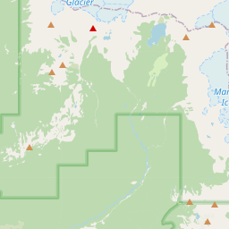
On the map


Last price
—
Floor price
—
7-day median
—
30-day sales
0
30-day range
—
In circulation
0
Price history
median
low – high
sales
No sales in this period
Show table
| Date | median | Low | High | sales |
|---|
Sales history
- Last sale
- —
- 30-day average
- —
- 30-day low
- —
- 30-day high
- —
- Sales 7d
- 0
- Sales 30d
- 0
No sales yet.
Anonymous sales: no buyer or seller shown. Figures count player-to-player sales only.
From Wikipedia
Mount Garibaldi (Squamish: Nch'ḵay̓, pronounced [n̩.ʧʼqɛˀj̰]) is a dormant stratovolcano in the Garibaldi Ranges of the Pacific Ranges in southwestern British Columbia, Canada. It has a maximum elevation of 2,678 metres (8,786 feet) and rises above the surrounding landscape on the east side of the Cheakamus River in New Westminster Land District. In addition to the main peak, Mount Garibaldi has two named sub-peaks. Atwell Peak is a sharp, conical peak slightly higher than the more rounded peak of Dalton Dome. Both were volcanically active at different times throughout Mount Garibaldi's eruptive history. The northern and eastern flanks of Mount Garibaldi are obscured by the Garibaldi Névé, a large snowfield containing several radiating glaciers. Flowing from the steep western face of Mount Garibaldi is the Cheekye River, a tributary of the Cheakamus River. Opal Cone on the southeastern flank is a small volcanic cone from which a lengthy lava flow descends. The western face is a landslide feature that formed in a series of collapses between 12,800 and 11,500 years ago. These collapses resulted in the formation of a large debris flow deposit that fans out into the Squamish Valley. Mount Garibaldi has been the focus of intermittent volcanic activity over the last 260,000 years. This activity produced mostly dacite, the main type of volcanic rock forming Mount Garibaldi. Volcanism between 260,000 and 220,000 years ago constructed an ancestral cone that was subsequently destroyed. Another growth period began with the eruption of Atwell Peak about 13,000 years ago when Mount Garibaldi was surrounded by an ice sheet during the last glacial period. The latest period of volcanic activity took place about 10,000 years ago with eruptions from Dalton Dome and Opal Cone after the ice sheet retreated. Although the mountain is not known to have been volcanically active since that...
Text: Wikipédia, CC BY-SA 4.0. · Image: Tim Gage (CC BY-SA 2.0) ·
Related cards

Mount Caubvick
Mountain in Canada, highest summit in Quebec and Newfoundland and Labrador
Nº Q3321804 ★★

Mount Waddington
Mountain of the Coast Mountains in British Columbia, Canada
Nº Q1737059 ★★

The Barrier
Cliff in British Columbia, Canada
Nº Q6966022 ★

Mount Adams (Washington)
Southern Washington stratovolcano in the Cascade Volcanic Arc
Nº Q267646 ★★

Laurentian Mountains
Mountain range in Labrador and Quebec, Canada
Nº Q75596 ★★★

Mont Ross
Mountain in French Southern and Antarctic Lands, France
Nº Q1945447 ★★