
Nilambur
Town in Malappuram district, Kerala, India
Nilambur (Malayalam: [n̪ilɐmbuːr]) is a major town, a municipality and a taluk in the Malappuram district of the Indian state of Kerala. It is located close to the Nilgiris range of the Western Ghats on the banks of the Chaliyar River.
Nº Q3525638 ★
Common · Places
Nilambur
Town in Malappuram district, Kerala, India
Nilambur (Malayalam: [n̪ilɐmbuːr]) is a major town, a municipality and a taluk in the Malappuram district of the Indian state of Kerala. It is located close to the Nilgiris range of the Western Ghats on the banks of the Chaliyar River.
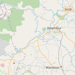
On the map
Last price
—
Floor price
—
7-day median
—
30-day sales
0
30-day range
—
In circulation
0
Price history
median
low – high
sales
No sales in this period
Show table
| Date | median | Low | High | sales |
|---|
Sales history
- Last sale
- —
- 30-day average
- —
- 30-day low
- —
- 30-day high
- —
- Sales 7d
- 0
- Sales 30d
- 0
No sales yet.
Anonymous sales: no buyer or seller shown. Figures count player-to-player sales only.
From Wikipedia
Nilambur (Malayalam: [n̪ilɐmbuːr]) is a major town, a municipality and a taluk in the Malappuram district of the Indian state of Kerala. It is located close to the Nilgiris range of the Western Ghats on the banks of the Chaliyar River. This place is also known as 'Teak Town' because of the abundance of Nilambur teaks, which is a variety of a large, deciduous tree that occurs in mixed hardwood forests. Unlike many municipalities of India, Nilambur is covered with large amounts of vegetation, making it very scenic. In the British records, Nilambur and its surroundings are collectively described as Nilambur Valley. The bank of river Chaliyar at Nilambur region is also known for natural gold fields. Explorations done at the valley of the river Chaliyar in Nilambur has shown reserves of the order of 2.5 million cubic meters of placers with 0.1 gram per cubic meter of gold. The hilly forested area of Nilambur Taluk forms a portion of the Nilgiri Biosphere Reserve of rich biodiversity. Nilambur is located about 90 km (56 mi) west of Ooty and 48 km (30 mi) southwest of Gudalur town, and 27 km (17 mi) northeast of Manjeri, on Ooty-Gudalur-Nilambur-Calicut road. The 2,554 m (8,379 ft) m high Mukurthi peak, which is situated in the border of Nilambur Taluk and Ooty Taluk, and is also the fifth-highest peak in South India as well as the third-highest in Kerala after Anamudi (2,696 m [8,845 ft]) and Meesapulimala (2,651 m [8,698 ft]), is the highest point of elevation in Malappuram district. It is also the highest peak in Kerala outside the Idukki district. The 2,383 m (7,818 ft) high Anginda peak, which is located closer to Malappuram-Palakkad-Nilgiris district border is the second-highest peak. Vavul Mala, a 2,339 m [7,674 ft] high peak situated on the...
Text: Wikipédia, CC BY-SA 4.0. · Image: PP Yoonus (00919447948124) (CC BY-SA 3.0) ·
Related cards

Malappuram district
District of Kerala, India
Nº Q1030918 ★★

Perumbavoor
Suburb in Ernakulam district, Kerala, India
Nº Q2737591 ★

Thekkady
Town in Idukki district, Kerala, India
Nº Q3532776 ★★

Talakaveri
Village in Karnataka, India
Nº Q3519730 ★★

Siliguri
City in West Bengal, India
Nº Q5087 ★★★

Lambasingi
Village in Chintapalle mandal, Alluri Sitharama Raju district, Andhra Pradesh, India
Nº Q17069304 ★