
North China Plain
Largest alluvial plain of China
The North China Plain (simplified Chinese: 华北平原; traditional Chinese: 華北平原; pinyin: Huáběi Píngyuán) is a large-scale downfaulted rift basin formed in the late Paleogene and Neogene and then modified by the deposits of the Yellow River. It is the largest alluvial plain of China.
Nº Q147304 ★★
Uncommon · Places
North China Plain
Largest alluvial plain of China
The North China Plain (simplified Chinese: 华北平原; traditional Chinese: 華北平原; pinyin: Huáběi Píngyuán) is a large-scale downfaulted rift basin formed in the late Paleogene and Neogene and then modified by the deposits of the Yellow River. It is the largest alluvial plain of China.
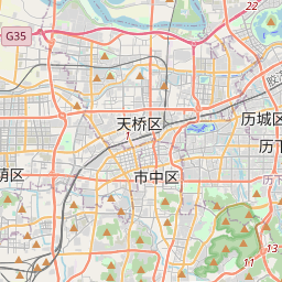
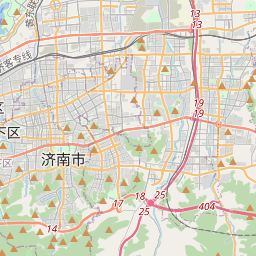
On the map
Last price
—
Floor price
—
7-day median
—
30-day sales
0
30-day range
—
In circulation
0
Price history
median
low – high
sales
No sales in this period
Show table
| Date | median | Low | High | sales |
|---|
Sales history
- Last sale
- —
- 30-day average
- —
- 30-day low
- —
- 30-day high
- —
- Sales 7d
- 0
- Sales 30d
- 0
No sales yet.
Anonymous sales: no buyer or seller shown. Figures count player-to-player sales only.
From Wikipedia
The North China Plain (simplified Chinese: 华北平原; traditional Chinese: 華北平原; pinyin: Huáběi Píngyuán) is a large-scale downfaulted rift basin formed in the late Paleogene and Neogene and then modified by the deposits of the Yellow River. It is the largest alluvial plain of China. The plain is bordered to the north by the Yanshan Mountains, to the west by the Taihang Mountains, to the south by the Dabie Mountains, and to the east by the Yellow Sea and Bohai Sea. The Yellow River flows through the plain, before its waters empty into the Bohai Sea. The part of the North China Plain around the banks of the middle and lower Yellow River is commonly referred to as the Central Plain (pinyin: Zhōngyuán). This portion of the North China Plain formed the cradle of Chinese civilization, and is the region from which the Han Chinese people emerged. Beijing, the capital of China, is located on the northeast edge of the plain, with Tianjin, an important industrial city and commercial port, near its northeast coast. Jinan (the capital of Shandong province) and Zhengzhou (the capital of Henan province) lie on the plain as well, along the banks of the Yellow River. Additionally, the capitals of several Imperial Chinese dynasties were located on the plain, including Luoyang (which at various points was the capital of the Han, Jin, Sui, and Tang dynasties) and Kaifeng (the capital of the Northern Song dynasty). The multipurpose Xiaolangdi Dam marks the location of the Yellow River's last valley before its waters flow onto the North China Plain, a great delta created from silt deposited at the Yellow River's mouth over millennia. The North China Plain encompasses much of Henan, Hebei, and Shandong provinces, as well as the northern portions of Jiangsu and Anhui. Further south, the North...
Text: Wikipédia, CC BY-SA 4.0. · Image: Song Hongxiao (CC BY-SA 3.0) ·
Related cards

Northeast China
Geographic region of China including Heilongjiang, Jilin, and Liaoning
Nº Q1057925 ★★★

Bohai Bay
Part of gulf of the Yellow Sea, in northeast China
Nº Q495341 ★

Yellow River
Major river in China
Nº Q7355 ★★★★
Bohai Sea
Sea in China
Nº Q181969 ★★★

Zhongyuan
Geographic region in China, centered in Henan province, usually covering the middle and lower reaches of the Yellow River Basin
Nº Q190277 ★★★

Grand Canal (China)
Longest canal or artificial river in the world located in China
Nº Q31347 ★★★