
Oğuzeli
District of Gaziantep, south-central Turkey
Oğuzeli is a municipality and district of Gaziantep Province, Turkey. Its area is 689 km2, and its population is 36 644 (2025). It is the 6th most populated district of Gaziantep, making it one of the smaller and rural districts alongside Araban, Karkamış, Nurdağı, Yavuzeli.
Nº Q1022230 ★★★★
Super Rare · Places
Oğuzeli
District of Gaziantep, south-central Turkey
Oğuzeli is a municipality and district of Gaziantep Province, Turkey. Its area is 689 km2, and its population is 36 644 (2025). It is the 6th most populated district of Gaziantep, making it one of the smaller and rural districts alongside Araban, Karkamış, Nurdağı, Yavuzeli.
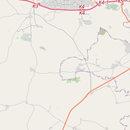
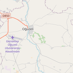
On the map
Last price
—
Floor price
—
7-day median
—
30-day sales
0
30-day range
—
In circulation
0
Price history
median
low – high
sales
No sales in this period
Show table
| Date | median | Low | High | sales |
|---|
Sales history
- Last sale
- —
- 30-day average
- —
- 30-day low
- —
- 30-day high
- —
- Sales 7d
- 0
- Sales 30d
- 0
No sales yet.
Anonymous sales: no buyer or seller shown. Figures count player-to-player sales only.
From Wikipedia
Oğuzeli is a municipality and district of Gaziantep Province, Turkey. Its area is 689 km2, and its population is 36 644 (2025). It is the 6th most populated district of Gaziantep, making it one of the smaller and rural districts alongside Araban, Karkamış, Nurdağı, Yavuzeli. Nevertheless, it is the closest district to the two urban districts of Şehitkamil and Şahinbey that make up Gaziantep City, with its municipal center located just Southeast of the city and the district bordering Hasan Kalyoncu University located at the edge of Şahinbey. As a suburban district, large areas of the district are made of agricultural farms, most particularly used for growing pistachios. The town is historically inhabited by Turkmens of the Barak tribe and Abdals of the Maya Sekenler tribe. The suburban district is most significant for housing the Gaziantep GZT Airport, historically referred to as Oğuzeli International Airport, as the 10th busiest airport in Türkiye as of 2025, connecting Gaziantep to many domestic and international destinations. The district is not linked with rail connections and while scheduled shuttle busses going to and from the airport exist, the only ways of reaching the municipal settlement of Oğuzeli remain to be busses and private cars. It is reached through the E90 European motorway, connecting to the O-54 Gaziantep Ring Road, exiting it at its Southeastern edge.
Text: Wikipédia, CC BY-SA 4.0. · Image: Batuhan duz (CC BY-SA 4.0) ·
Related cards

Şahinbey
District of Gaziantep, south-central Turkey
Nº Q2195037 ★★★★

Yavuzeli
District and town of Gaziantep, Turkey
Nº Q1027149 ★★★

Şehitkamil
District of Gaziantep, south-central Turkey
Nº Q388703 ★

Gaziantep Province
Province in south-central Turkey
Nº Q483154 ★★

Eyyübiye
District of Şanlıurfa, southeastern Turkey
Nº Q16957471 ★

Orhaneli
District of Bursa, northwestern Turkey
Nº Q1948420 ★★★★