
Olmaliq
City in Uzbekistan
Olmaliq (Uzbek: Olmaliq / Олмалиқ) is a district-level city (2021 pop 133,400) in the Tashkent Region of central Uzbekistan, approximately 65 km east of Tashkent. It is located at latitude 40° 50' 41N; longitude 69° 35' 54E; at an altitude of 585 meters.
Nº Q986429 ★★★
Rare · Places
Olmaliq
City in Uzbekistan
Olmaliq (Uzbek: Olmaliq / Олмалиқ) is a district-level city (2021 pop 133,400) in the Tashkent Region of central Uzbekistan, approximately 65 km east of Tashkent. It is located at latitude 40° 50' 41N; longitude 69° 35' 54E; at an altitude of 585 meters.
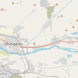
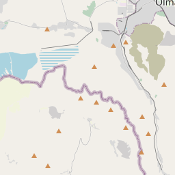
On the map


Last price
—
Floor price
—
7-day median
—
30-day sales
0
30-day range
—
In circulation
0
Price history
median
low – high
sales
No sales in this period
Show table
| Date | median | Low | High | sales |
|---|
Sales history
- Last sale
- —
- 30-day average
- —
- 30-day low
- —
- 30-day high
- —
- Sales 7d
- 0
- Sales 30d
- 0
No sales yet.
Anonymous sales: no buyer or seller shown. Figures count player-to-player sales only.
From Wikipedia
Olmaliq (Uzbek: Olmaliq / Олмалиқ) is a district-level city (2021 pop 133,400) in the Tashkent Region of central Uzbekistan, approximately 65 km east of Tashkent. It is located at latitude 40° 50' 41N; longitude 69° 35' 54E; at an altitude of 585 meters. Olmaliq is a company town developed by the Soviet Union in the 1930s, to exploit local reserves of copper, lead, zinc, gold, silver and barite. The town contains several enormous smelting facilities and related industries operated today by JSC Almalyk MMC, one of the largest mining-metallurgical enterprises in Uzbekistan. The smelter operations have extensively contaminated Almalyk, which is considered one of the most polluted places on earth. The air has high concentrations of sulfuric acid fumes and the ground has hundreds of tons of toxic waste. The Uzbek government has resisted calls to close the plant, arguing that the country's economy cannot afford to do so: The plant employs around 25,000 residents of the city, and accounts for a substantial share of the region's economy. However, in January 2005 the government announced plans to clean up the area, with a target of 2010.
Text: Wikipédia, CC BY-SA 4.0. · Image: Vol71193 (CC BY-SA 4.0) ·
Related cards

Route Napoléon
Route taken by Napoleon in 1815 on his return from Elba
Nº Q1271253 ★★★

Royal Botanic Gardens, Kew
Government botanical research institute in the UK
Nº Q18748726 ★★★

Markina-Xemein
Municipality of Spain
Nº Q604810 ★★★

Nakhl Taqi
City in Bushehr Province, Iran
Nº Q2632780 ★★★

San Sperate
Italian comune
Nº Q284850 ★★★
Adly Mansour Transportation Hub
Interchange station in Cairo, Egypt
Nº Q112874062 ★★★