
Peloritani
Mountain range
The Peloritani (Sicilian: Piluritani, Italian: Monti Peloritani) are a mountain range of north-eastern Sicily, in southern Italy, extending for some 65 km (40 mi) from Capo Peloro to the Nebrodi Mountains. On the north and east they are bordered by the Tyrrhenian and Ionian Seas respectively, and on the south by the Alcantara River .
Nº Q599804 ★★★
Rare · Places
Peloritani
Mountain range
The Peloritani (Sicilian: Piluritani, Italian: Monti Peloritani) are a mountain range of north-eastern Sicily, in southern Italy, extending for some 65 km (40 mi) from Capo Peloro to the Nebrodi Mountains. On the north and east they are bordered by the Tyrrhenian and Ionian Seas respectively, and on the south by the Alcantara River .
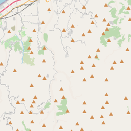
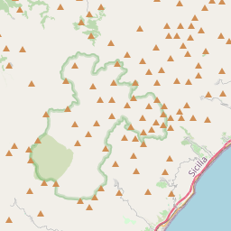
On the map
Last price
—
Floor price
—
7-day median
—
30-day sales
0
30-day range
—
In circulation
0
Price history
median
low – high
sales
No sales in this period
Show table
| Date | median | Low | High | sales |
|---|
Sales history
- Last sale
- —
- 30-day average
- —
- 30-day low
- —
- 30-day high
- —
- Sales 7d
- 0
- Sales 30d
- 0
No sales yet.
Anonymous sales: no buyer or seller shown. Figures count player-to-player sales only.
From Wikipedia
The Peloritani (Sicilian: Piluritani, Italian: Monti Peloritani) are a mountain range of north-eastern Sicily, in southern Italy, extending for some 65 km (40 mi) from Capo Peloro to the Nebrodi Mountains. On the north and east they are bordered by the Tyrrhenian and Ionian Seas respectively, and on the south by the Alcantara River . The highest peaks are the Montagna Grande (1,374 m, 4,508 ft), the Rocca di Novara (1,340 m, 4,400 ft), the Pizzo di Vernà (1,287 m, 4,222 ft), the Monte Poverello (1,279 m, 4,196 ft) and the Monte Scuderi (1,253 m, 4,111 ft). The range is made up of a long series of peaks, with an average height of 800–1,000 m (2,600–3,300 ft), intermingled with ridges and ravines. The deep gorges house numerous streams that create the typical rivers of this land called fiumare, often full of deprises in their inferior flow. The most common rocks are of igneous and metamorphic origin. Sandstone soils are also present. Of unusual origin are the megaliths rocks of the Argimusco plateau. Historical-Archaeological Relations and Toponymic Analogies between the Ausonian-Auruncan Lazio and the Tyrrhenian-Peloritan Area1. The Scientific Framework and Archaeogenetic EvidenceRecent developments in international archaeogenetic research have shed new light on the population dynamics of protohistoric Italy. A fundamental study published in September 2021 in the scientific journal Science Advances — conducted by a multinational team coordinated by the Max Planck Institute for the Science of Human History in Jena and the University of Florence — has demonstrated substantial genetic homogeneity among the main populations of the Iron Age in central Italy (including Etruscans and Latins) . Biogeographic data indicate a common ancestral root linked to migrations from the Eurasian steppes during the Bronze Age, genetically unifying the peoples of the central Tyrrhenian area, historically associated with the Ausonians and...
Text: Wikipédia, CC BY-SA 4.0. · Image: Wikimedia Commons (CC BY-SA 3.0) ·
Related cards

Nebrodi
Mountain range
Nº Q1547109 ★★★★

Argimusco
High plateau in Sicily
Nº Q3622428 ★★★

Monte Dinnammare
Mountain in Italy
Nº Q21194637 ★★

Apennine Mountains
Mountain range stretching 1200 km from the north to the south of Italy, traversing the entire peninsula, and forming the backbone of the country
Nº Q1285 ★★★★★

Mountains of Palermo
Nº Q3862476 ★★★

Monti Ernici
Mountain range in Italy
Nº Q957717 ★★★