
Salso
River of Sicily
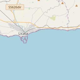
The Salso (Sicilian: Salsu/Sarsu), also known as the Imera Meridionale (Greek: Ἱμέρας; Latin: Himera), is a river in Sicily, Italy. It rises in the Madonie Mountains (Sicilian: Munti Madunìi; Latin: Nebrodes Mons) and, traversing the provinces of Enna and Caltanissetta, flows into the Mediterranean at the western end of the Gulf of Gela at the seaport of Licata, in the province of Agrigento.
Nº Q24358 ★★
Uncommon · Places
Salso
River of Sicily
The Salso (Sicilian: Salsu/Sarsu), also known as the Imera Meridionale (Greek: Ἱμέρας; Latin: Himera), is a river in Sicily, Italy. It rises in the Madonie Mountains (Sicilian: Munti Madunìi; Latin: Nebrodes Mons) and, traversing the provinces of Enna and Caltanissetta, flows into the Mediterranean at the western end of the Gulf of Gela at the seaport of Licata, in the province of Agrigento.
On the map
Last price
—
Floor price
—
7-day median
—
30-day sales
0
30-day range
—
In circulation
0
Price history
median
low – high
sales
No sales in this period
Show table
| Date | median | Low | High | sales |
|---|
Sales history
- Last sale
- —
- 30-day average
- —
- 30-day low
- —
- 30-day high
- —
- Sales 7d
- 0
- Sales 30d
- 0
No sales yet.
Anonymous sales: no buyer or seller shown. Figures count player-to-player sales only.
From Wikipedia
The Salso (Sicilian: Salsu/Sarsu), also known as the Imera Meridionale (Greek: Ἱμέρας; Latin: Himera), is a river in Sicily, Italy. It rises in the Madonie Mountains (Sicilian: Munti Madunìi; Latin: Nebrodes Mons) and, traversing the provinces of Enna and Caltanissetta, flows into the Mediterranean at the western end of the Gulf of Gela at the seaport of Licata, in the province of Agrigento. Its small deltaic system there is dominated by marine processes rather than fluvial ones. It is a seasonal torrent, with brief but violent floods during the winter rains (from November to February), and all but dry in summer droughts. In November 1915 the iron bridge across the river's mouth collapsed during floods, and 119 people were swept away in the flood and lost. The Salso, which is the longest river of Sicily at 132 kilometres (82 mi), has a drainage basin area of 2,022 square kilometres (781 mi2). The river's historically changeable meanders across the low coastal plain have been artificially channeled into the Canale di Sicilia, and the marshes drained for agriculture. Until the late nineteenth century it had two distributary channels, the second debouching 5 kilometres (3 mi) to the west. The mouth of the Salso has been advancing during historical times, and wind and wave formerly distributed its sand and silt to the beaches of the Gulf of Gela.
Text: Wikipédia, CC BY-SA 4.0. · Image: AlessandroAM (CC BY-SA 4.0) ·
Related cards
-

Simeto
River in Sicily
Nº Q1235338 ★★★
Not listed
-

Platani (river)
River in Italy
Nº Q187904 ★★
Not listed
-

Corace
River in Italy
Nº Q725720 ★★
Not listed
-

Irminio
River in Italy
Nº Q854834 ★★
Not listed
-

Neto (river)
River of Calabria, Italy
Nº Q609648 ★★
Not listed
-

Salzach
River in Austria and Germany
Nº Q152661 ★★★★
Not listed