

Uncommon · Places
Saqiya
Village in Jaffa, Mandatory Palestine
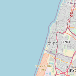
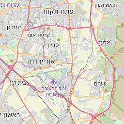
Saqiya (Arabic: ساقِية, the Arabic name of a mechanical water lifting device) was a village in Palestine (Jaffa district) 8.5 kilometers (5.3 mi) away from Jaffa, depopulated in 1948.
On the map
From Wikipedia
Saqiya (Arabic: ساقِية, the Arabic name of a mechanical water lifting device) was a village in Palestine (Jaffa district) 8.5 kilometers (5.3 mi) away from Jaffa, depopulated in 1948. The village was located 8.5 kilometers (5.3 mi) east of Jaffa, 25 meters (82 ft) above sea level, on uneven land in the central coastal plain. A number of paved roads passing through or near the village allowed them to easy access to Ludd and Jaffa, Tel Aviv, as well as the villages adjacent to it. The village’s name denotes “Persian wheel, Latin tympanum”. In 1596, under Ottoman rule, Saqiya was a village in the nahiya of Ramla, part of Sanjak Gaza, with a population of 49 households, an estimated 270 people, all Muslim. They paid a fixed tax-rate of 33,3% on agricultural products, including wheat, barley, fruit and sesame, as well as on other types of property, such as goats, beehives and vineyards; a total of 14,300 akçe. 10/24 parts of the revenue went to a Waqf. The Syrian Sufi teacher and traveller Mustafa al-Bakri al-Siddiqi (1688-1748/9), who toured the region in the first half of the eighteenth century, wrote that he passed through Saqiya while he was on his way to Jaffa. An Ottoman village list of about 1870 showed that Saqiya had 53 houses and a population of 168, though the population count included men only. In the 1882, the PEF's Survey of Western Palestine found that the village had a well to the south.
Text: Wikipédia, CC BY-SA 4.0. · Image: Sources for historical series of maps as follows: PEF Survey... (Public domain) ·