
Sarangani
Province of the Philippines
Sarangani, officially the Province of Sarangani (Cebuano: Lalawigan sa Sarangani; Hiligaynon: Kapuoran sang Sarangani; Maguindanaon: Dairat nu Sarangani, Jawi: دايرت نو سرڠان; Filipino: Lalawigan ng Sarangani), is a province in the Philippines located in the Soccsksargen region. Its capital is Alabel while Glan is the most populous municipality in the province.
Nº Q13877 ★
Common · Places
Sarangani
Province of the Philippines
Sarangani, officially the Province of Sarangani (Cebuano: Lalawigan sa Sarangani; Hiligaynon: Kapuoran sang Sarangani; Maguindanaon: Dairat nu Sarangani, Jawi: دايرت نو سرڠان; Filipino: Lalawigan ng Sarangani), is a province in the Philippines located in the Soccsksargen region. Its capital is Alabel while Glan is the most populous municipality in the province.
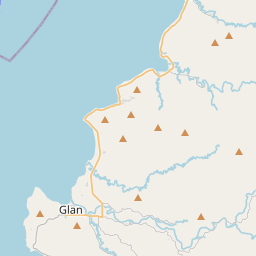
On the map

Last price
—
Floor price
—
7-day median
—
30-day sales
0
30-day range
—
In circulation
0
Price history
median
low – high
sales
No sales in this period
Show table
| Date | median | Low | High | sales |
|---|
Sales history
- Last sale
- —
- 30-day average
- —
- 30-day low
- —
- 30-day high
- —
- Sales 7d
- 0
- Sales 30d
- 0
No sales yet.
Anonymous sales: no buyer or seller shown. Figures count player-to-player sales only.
From Wikipedia
Sarangani, officially the Province of Sarangani (Cebuano: Lalawigan sa Sarangani; Hiligaynon: Kapuoran sang Sarangani; Maguindanaon: Dairat nu Sarangani, Jawi: دايرت نو سرڠان; Filipino: Lalawigan ng Sarangani), is a province in the Philippines located in the Soccsksargen region. Its capital is Alabel while Glan is the most populous municipality in the province. With a 230-kilometer (140 mi) coastline along the Sarangani Bay and Celebes Sea, the province is at the southernmost tip of Mindanao island, and borders South Cotabato and Davao del Sur to the north, Davao Occidental to the east, and the Celebes Sea to the south. Sarangani is part of the South Cotabato-Cotabato-Sultan Kudarat-Sarangani-General Santos (Soccsksargen) development cluster, and is linked by paved roads to the international airport and harbor of General Santos. The province is divided into two sections, separated by the Sarangani Bay and the city of General Santos, and it used to be part of South Cotabato until it was made an independent province in 1992.
Text: Wikipédia, CC BY-SA 4.0. · Image: Ryan Jose Ruiz III (CC BY-SA 3.0) ·
Related cards

South Cotabato
Province of the Philippines
Nº Q13882 ★

Davao del Sur
Province of the Philippines
Nº Q13794 ★

Pangasinan
Province of the Philippines
Nº Q13871 ★★★

Davao Occidental
Province of the Philippines
Nº Q3656379 ★

Laguna (province)
Province of the Philippines
Nº Q13840 ★★

Zamboanga del Sur
Province of the Philippines
Nº Q13900 ★