
Satpura Range
Range of Hills in Central India which runs through Maharashtra and Madhya Pradesh
The Satpura Range (IPA: [sət̪pʊɽaː]), formerly also known as the Seeonee Hills, is a range of hills in central India. The range rises in eastern Gujarat running east through the border of Maharashtra and Madhya Pradesh and ends in Chhattisgarh.
Nº Q1145416 ★★
Uncommon · Places
Satpura Range
Range of Hills in Central India which runs through Maharashtra and Madhya Pradesh
The Satpura Range (IPA: [sət̪pʊɽaː]), formerly also known as the Seeonee Hills, is a range of hills in central India. The range rises in eastern Gujarat running east through the border of Maharashtra and Madhya Pradesh and ends in Chhattisgarh.
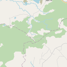
On the map

Last price
—
Floor price
—
7-day median
—
30-day sales
0
30-day range
—
In circulation
0
Price history
median
low – high
sales
No sales in this period
Show table
| Date | median | Low | High | sales |
|---|
Sales history
- Last sale
- —
- 30-day average
- —
- 30-day low
- —
- 30-day high
- —
- Sales 7d
- 0
- Sales 30d
- 0
No sales yet.
Anonymous sales: no buyer or seller shown. Figures count player-to-player sales only.
From Wikipedia
The Satpura Range (IPA: [sət̪pʊɽaː]), formerly also known as the Seeonee Hills, is a range of hills in central India. The range rises in eastern Gujarat running east through the border of Maharashtra and Madhya Pradesh and ends in Chhattisgarh. The range parallels the Vindhya Range to the north, and these two east–west ranges divide the Indian subcontinent into the Indo-Gangetic Plain of northern India and the Deccan Plateau of the south. The Narmada River originates from the north-eastern end of Satpura in Amarkantak, and runs in the depression between the Satpura and Vindhya ranges, draining the northern slope of the Satpura range, running west towards the Arabian Sea. The Tapti River originates in the eastern-central part of Satpura, crossing the range in the center and running west at the range's southern slopes before meeting the Arabian Sea at Surat, draining the central and southern slopes of the range. Multai, the place of Tapti river origin is located about 465 kilometer far, south-westerly to Amarkantak, separated across by the hill range. The Godavari River and its tributaries drain the Deccan Plateau, which lies south of the range, and the Mahanadi River drains the easternmost portion of the range. The Godavari and Mahanadi rivers flow into the Bay of Bengal. At its eastern end, the Satpura range meets the hills of the Chotanagpur Plateau. The Satpura Range is a horst mountain and is flanked by Narmada Graben in the north and the much smaller but parallel Tapi Graben in the south.
Text: Wikipédia, CC BY-SA 4.0. · Image: Abhayashok (CC BY-SA 3.0) ·
Related cards

Vindhya Range
Mountain Range in central India
Nº Q271435 ★★

Pachmarhi
Hill station in India
Nº Q1949041 ★★

Amarkantak
Hlll station in Madhya Pradesh, India
Nº Q588826 ★★

Western Ghats
Mountain range along the western coast of India
Nº Q4527 ★★★

Parasnath
Hill in Giridih district, Jharkhand, India
Nº Q21099460 ★★★

Savandurga
Hill in Bangalore Rural district, India
Nº Q2723663 ★