

Common · Places
Sedbergh
Town and civil parish in Cumbria, United Kingdom
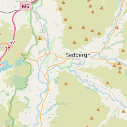
Sedbergh ( SED-bər or locally SEB-ər) is a town and civil parish in the Westmorland and Furness area of the ceremonial county of Cumbria, England, about 10 miles (16 km) east of Kendal, 28 miles (45 km) north of Lancaster and about 10 miles (16 km) north of Kirkby Lonsdale. It was historically part of the West Riding of Yorkshire.
On the map
From Wikipedia
Sedbergh ( SED-bər or locally SEB-ər) is a town and civil parish in the Westmorland and Furness area of the ceremonial county of Cumbria, England, about 10 miles (16 km) east of Kendal, 28 miles (45 km) north of Lancaster and about 10 miles (16 km) north of Kirkby Lonsdale. It was historically part of the West Riding of Yorkshire. In 2021, the civil parish had a population of 2,765. It lies within the Yorkshire Dales National Park at the foot of Howgill Fells, on the north bank of the River Rawthey, which joins the River Lune 2 miles (3 km) below the town.
Text: Wikipédia, CC BY-SA 4.0. · Image: Zaian at English Wikipedia (Public domain) ·
Related cards
-
 ★★
★★
Kendal
Town and civil parish in South Lakeland, Cumbria, England
-
 ★
★
Kirkby Lonsdale
Town in Cumbria, England, UK
-
 ★
★
Westmorland and Furness
Unitary authority area in Cumbria, England
-
 ★★
★★
Sedbergh School
School in Cumbria, UK
-
 ★★
★★
Westmorland
Historic county of England
-
 ★
★
Coniston, Cumbria
Village and civil parish in Cumbria, England, UK