
Semuc Champey
Natural monument in Alta Verapaz, Guatemala
Semuc Champey is a natural enclave in the department of Alta Verapaz, Guatemala, it consists of a natural 300-metre (980 ft) karst landbridge formed by travertine limestone deposits, beneath which the main flow of the Cahabón River plunges into a subterranean cave system via a natural sinkhole (known locally as El Sumidero). Located near the Q'eqchi' Maya town of Lanquín, the top of this limestone formation features a stepped series of natural, turquoise-green pools fed by mountain spring runoff, creating a unique freshwater ecosystem within th...
Nº Q1850670 ★★★
Rare · Places
Semuc Champey
Natural monument in Alta Verapaz, Guatemala
Semuc Champey is a natural enclave in the department of Alta Verapaz, Guatemala, it consists of a natural 300-metre (980 ft) karst landbridge formed by travertine limestone deposits, beneath which the main flow of the Cahabón River plunges into a subterranean cave system via a natural sinkhole (known locally as El Sumidero). Located near the Q'eqchi' Maya town of Lanquín, the top of this limestone formation features a stepped series of natural, turquoise-green pools fed by mountain spring runoff, creating a unique freshwater ecosystem within th...
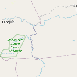
On the map
Last price
—
Floor price
—
7-day median
—
30-day sales
0
30-day range
—
In circulation
0
Price history
median
low – high
sales
No sales in this period
Show table
| Date | median | Low | High | sales |
|---|
Sales history
- Last sale
- —
- 30-day average
- —
- 30-day low
- —
- 30-day high
- —
- Sales 7d
- 0
- Sales 30d
- 0
No sales yet.
Anonymous sales: no buyer or seller shown. Figures count player-to-player sales only.
From Wikipedia
Semuc Champey is a natural enclave in the department of Alta Verapaz, Guatemala, it consists of a natural 300-metre (980 ft) karst landbridge formed by travertine limestone deposits, beneath which the main flow of the Cahabón River plunges into a subterranean cave system via a natural sinkhole (known locally as El Sumidero). Located near the Q'eqchi' Maya town of Lanquín, the top of this limestone formation features a stepped series of natural, turquoise-green pools fed by mountain spring runoff, creating a unique freshwater ecosystem within the subtropical rainforest of the Petén-Verapaz region. The name Semuc Champey is from the Qʼeqchiʼ language, meaning where the river hides under the earth. The natural monument was established in 2005 by Decreto No. 025. The best and most popular way to see Semuc Champey is from the "El Mirador" viewpoint. Though it is a roughly 45-minute hot, uphill jungle hike from the parking area, the views into the valley are unparalleled. Although it can be difficult to get to, Semuc is becoming more and more popular with travelers.
Text: Wikipédia, CC BY-SA 4.0. · Image: Lucía García González (CC0) ·
Related cards

Alta Verapaz
Department of Guatemala
Nº Q504637 ★★★

Vat Phou
Hindu temples complex and ruins in Laos (UNESCO site)
Nº Q579860 ★★

Chamechaude
Mountain in France
Nº Q2321630 ★★★

Quiriguá
Ancient Maya archaeological site in south-eastern Guatemala
Nº Q318422 ★★★

Quiché Department
Department of Guatemala
Nº Q669802 ★★★

Mashuk
Mountain in the northeastern part of the city of Pyatigorsk in the North Caucasus, Russia
Nº Q1963949 ★★★