

Common · Places
Thallichtenberg
Municipality of Germany
Thallichtenberg is an Ortsgemeinde – a municipality belonging to a Verbandsgemeinde, a kind of collective municipality – in the Kusel district in Rhineland-Palatinate, Germany. It belongs to the Verbandsgemeinde of Kusel-Altenglan, whose seat is in Kusel.
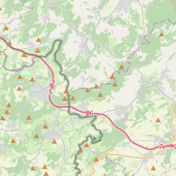
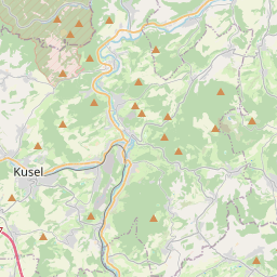
On the map
From Wikipedia
Thallichtenberg is an Ortsgemeinde – a municipality belonging to a Verbandsgemeinde, a kind of collective municipality – in the Kusel district in Rhineland-Palatinate, Germany. It belongs to the Verbandsgemeinde of Kusel-Altenglan, whose seat is in Kusel. The municipality lies in the Kusel Musikantenland in the Western Palatinate. The municipal area measures 571 ha, of which 163 ha is wooded. Thallichtenberg lies roughly 300 m above sea level northwest of Lichtenberg Castle (382 m above sea level) in a broad hollow between the Burgberg (“Castle Mountain”) and the so-called Prussian Mountains (Preußische Berge), which here, on the heights of the Wolfsbösch, reach 572 m above sea level. Down in the dale, the village site abuts the Pfeffelbach (brook), which here turns from its south-to-north direction of flow towards the east, forming a narrow gorge between the Burgberg and the Niederberg within Ruthweiler’s limits. Several small brooks (Löschbach, Bisterbach, Kurzer Bach) flow into the Pfeffelbach within Thallichtenberg. Thallichtenberg borders in the north on the town of Baumholder, in the northeast and east on the municipality of Körborn, in the southeast on the municipality of Ruthweiler, in the south on the municipality of Pfeffelbach, in the west on the municipality of Berschweiler bei Baumholder and in the northwest on the municipality of Mettweiler. Also belonging to Thallichtenberg are the outlying homesteads of Burg Lichtenberg and Berghof. The village of Thallichtenberg shows the attributes of a typical clump village, with streets spreading out in a starlike shape from the midpoint into the dales through which the smaller brooks flow and over the heights in between.
Text: Wikipédia, CC BY-SA 4.0. · Image: LoKiLeCh (CC BY-SA 3.0) ·