
Abu Shusha
Village in Ramle, Mandatory Palestine
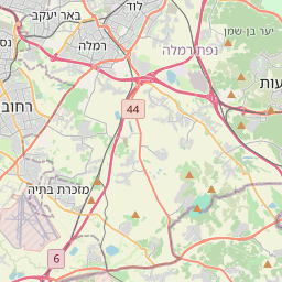
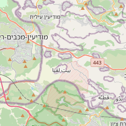
Abu Shusha (Arabic: أبو شوشة) was a Palestinian Arab village in the Ramle Subdistrict of Mandatory Palestine, located 8 km southeast of Ramle. It was ethnically cleansed in May 1948. Abu Shusha was located on the slope of Tell Jezer/Tell el-Jazari, which is commonly identified with the ancient city of Gezer.
Nº Q4670360 ★★
Poco común · Lugares
Abu Shusha
Village in Ramle, Mandatory Palestine
Abu Shusha (Arabic: أبو شوشة) was a Palestinian Arab village in the Ramle Subdistrict of Mandatory Palestine, located 8 km southeast of Ramle. It was ethnically cleansed in May 1948. Abu Shusha was located on the slope of Tell Jezer/Tell el-Jazari, which is commonly identified with the ancient city of Gezer.
En el mapa
Último precio
—
Precio mínimo
—
Mediana 7 d
—
Ventas 30 d
0
Rango 30 d
—
En circulación
0
Cotización
mediana
mín – máx
ventas
Sin ventas en el periodo
Ver tabla
| Fecha | mediana | Mín | Máx | ventas |
|---|
Historial de ventas
- Última venta
- —
- Media 30 d
- —
- Mínimo 30 d
- —
- Máximo 30 d
- —
- Ventas 7 d
- 0
- Ventas 30 d
- 0
Aún no hay ventas.
Ventas anónimas: sin comprador ni vendedor. Las cifras solo cuentan ventas entre jugadores.
En Wikipedia
Texto en inglés Aún no hay artículo en tu idioma: extracto en inglés.
Abu Shusha (Arabic: أبو شوشة) was a Palestinian Arab village in the Ramle Subdistrict of Mandatory Palestine, located 8 km southeast of Ramle. It was ethnically cleansed in May 1948. Abu Shusha was located on the slope of Tell Jezer/Tell el-Jazari, which is commonly identified with the ancient city of Gezer. In April–May 1948, during the 1948 Arab–Israeli War, Abu Shusha was attacked several times. The final assault began on May 13, one day prior to Israel's declaration of independence. Abu Shusha residents attempted to defend the village, but the village was occupied on May 14. The civilians who had not already fled or been killed were expelled by May 21. With their descendants, they numbered about 6,198 in 1998.
Texto: Wikipedia en inglés, CC BY-SA 4.0. · Imagen: Sources for historical series of maps as follows: PEF Survey... (Public domain) ·
Cartas cercanas

Abu Zurayq
Village in Haifa, Mandatory Palestine
Nº Q2254563 ★★

Dayr Abu Salama
Former village in Ramle District, Mandatory Palestine
Nº Q5243294 ★★★

Bayt Jiz
Village in Ramle, Mandatory Palestine
Nº Q2897385 ★★★

Al-Qubayba, Ramle
Village in Ramle, Mandatory Palestine
Nº Q4703091 ★★★

Jimzu
Village in Ramle, Mandatory Palestine
Nº Q2907137 ★★

Bayt Susin
Village in Ramle, Mandatory Palestine
Nº Q2897399 ★★