
Douve
Río de Francia
The Douve (French pronunciation: [duv]) or Ouve is a river, 78.6 km (48.8 mi) in length, which rises in the commune of Tollevast, near Cherbourg in the department of Manche. Ouve is considered its old name (Unva in ancient texts): Ouve appears to have been misspelled over the course of time as "Douve river" and then as "River of the Douve" (Douve literally means Ditch).
Nº Q1252782 ★★
Poco común · Lugares
Douve
Río de Francia
The Douve (French pronunciation: [duv]) or Ouve is a river, 78.6 km (48.8 mi) in length, which rises in the commune of Tollevast, near Cherbourg in the department of Manche. Ouve is considered its old name (Unva in ancient texts): Ouve appears to have been misspelled over the course of time as "Douve river" and then as "River of the Douve" (Douve literally means Ditch).
En el mapa
Último precio
—
Precio mínimo
—
Mediana 7 d
—
Ventas 30 d
0
Rango 30 d
—
En circulación
0
Cotización
mediana
mín – máx
ventas
Sin ventas en el periodo
Ver tabla
| Fecha | mediana | Mín | Máx | ventas |
|---|
Historial de ventas
- Última venta
- —
- Media 30 d
- —
- Mínimo 30 d
- —
- Máximo 30 d
- —
- Ventas 7 d
- 0
- Ventas 30 d
- 0
Aún no hay ventas.
Ventas anónimas: sin comprador ni vendedor. Las cifras solo cuentan ventas entre jugadores.
En Wikipedia
Texto en inglés Aún no hay artículo en tu idioma: extracto en inglés.
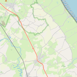
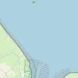
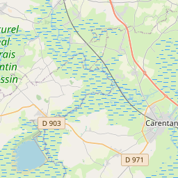
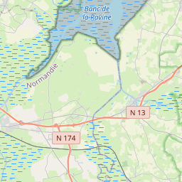
The Douve (French pronunciation: [duv]) or Ouve is a river, 78.6 km (48.8 mi) in length, which rises in the commune of Tollevast, near Cherbourg in the department of Manche. Ouve is considered its old name (Unva in ancient texts): Ouve appears to have been misspelled over the course of time as "Douve river" and then as "River of the Douve" (Douve literally means Ditch). The French name for this watercourse is la Douve. After passing Tollevast, the river proceeds through the hills of the Cotentin Peninsula (Cherbourg peninsula) and goes by Sottevast, l'Étang-Bertrand and Magneville. It borders Néhou and crosses Saint-Sauveur-le-Vicomte. Once it reaches Bauptois, it alters its direction towards the Bay of the Seine in the south-eastern English Channel, passing through Carentan. The Douve is a navigable river owing to its flat bottom and adequate depth of flow. In 1944 German troops, preparing Rommel's Fortress Europa, flooded the valley to prevent landing paratroops or gliders. On D-Day, the river was the boundary between the left flank of Allied landing forces on Utah Beach (on its left bank and so to the west nearest Rouen) and the bloody defensive battle that occurred at Omaha Beach. The Utah Beach landings were part of contingency planning only scheduled after ample landing craft became available and designed to give the Allies a leg up on taking a port city, in this case, Cherbourg, to bolster Allied logistical capacity. Had the landing craft been lacking, the river would have protected the exposed right flank of the allied invasion lodgement. With Utah in the plan, it was used to originate an offensive aimed squarely at the early domination of the peninsula and capture of Cherbourg and Caen (and eventually Rouen) at the opposite end of the lodgement. These cities were well protected by their...
Texto: Wikipedia en inglés, CC BY-SA 4.0. · Imagen: TCY (CC BY-SA 3.0) ·
Cartas cercanas
-

Dive
Río de Francia
Nº Q1129962 ★★
Sin ofertas
-

Río Dives
Río de Francia
Nº Q118784 ★★
Sin ofertas
-

río Vie
Río de Francia
Nº Q2523116 ★★
Sin ofertas
-

Doux (river)
Watercourse
Nº Q1252810 ★★
Sin ofertas
-

Évre
Río de Francia
Nº Q273241 ★
Sin ofertas
-

Río Ambleve
Nº Q461361 ★★
Sin ofertas