

Eriskay
Island of the Outer Hebrides in northern Scotland
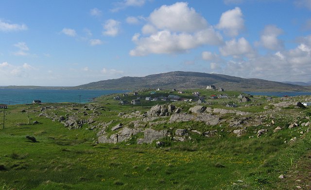
Eriskay (Scottish Gaelic: Èirisgeigh), from the Old Norse for "Eric's Isle", is an island and community council area of the Outer Hebrides in northern Scotland with a population of 160. It lies between South Uist and Barra and is connected to South Uist by a causeway which was opened in 2001.
Nº Q602689 ★
Común · Lugares
Eriskay
Island of the Outer Hebrides in northern Scotland
Eriskay (Scottish Gaelic: Èirisgeigh), from the Old Norse for "Eric's Isle", is an island and community council area of the Outer Hebrides in northern Scotland with a population of 160. It lies between South Uist and Barra and is connected to South Uist by a causeway which was opened in 2001.
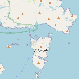
En el mapa


En Wikipedia
Texto en inglés Aún no hay artículo en tu idioma: extracto en inglés.
Eriskay (Scottish Gaelic: Èirisgeigh), from the Old Norse for "Eric's Isle", is an island and community council area of the Outer Hebrides in northern Scotland with a population of 160. It lies between South Uist and Barra and is connected to South Uist by a causeway which was opened in 2001. In the same year Ceann a' Ghàraidh in Eriskay became the ferry terminal for travelling between South Uist and Barra. The Caledonian MacBrayne vehicular ferry travels between Eriskay and Ardmore in Barra. The crossing takes around 40 minutes.
Texto: Wikipedia en inglés, CC BY-SA 4.0. · Imagen: Richard Webb (CC BY-SA 2.0) ·
Cartas cercanas
-

Barra (Escocia)
Isla en Escocia
Nº Q223212 ★★
Sin ofertas
-

Castlebay
Village and community council area on the island of Barra, Scotland
Nº Q1049581 ★
Sin ofertas
-

Berneray, North Uist
Island in the Sound of Harris, Outer Hebrides, Scotland, UK
Nº Q682618 ★
Sin ofertas
-

Islay
Isla más austral de las Hébridas Interiores, en Escocia
Nº Q273 ★★★
Sin ofertas
-

Eysturoyartunnilin
Sub-sea tunnel in the Faroe Islands, connecting Runavík and Strendur with Tórshavn
Nº Q27830387 ★★
Sin ofertas
-

Uist
Central group of islands in the Outer Hebrides of Scotland
Nº Q354289 ★
Sin ofertas