
Fruta de Leite
Municipality in the northeast of the Brazilian state of Minas Gerais
Fruta de Leite is a municipality in the northeast of the Brazilian state of Minas Gerais. As of 2020 the population was 5,299 in a total area of 758 km2 (293 sq mi). The elevation is 910 metres (2,990 ft).
Nº Q1791158 ★★★
Rara · Lugares
Fruta de Leite
Municipality in the northeast of the Brazilian state of Minas Gerais
Fruta de Leite is a municipality in the northeast of the Brazilian state of Minas Gerais. As of 2020 the population was 5,299 in a total area of 758 km2 (293 sq mi). The elevation is 910 metres (2,990 ft).
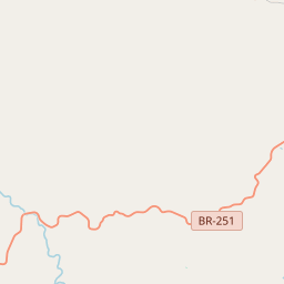
En el mapa
Último precio
—
Precio mínimo
—
Mediana 7 d
—
Ventas 30 d
0
Rango 30 d
—
En circulación
0
Cotización
mediana
mín – máx
ventas
Sin ventas en el periodo
Ver tabla
| Fecha | mediana | Mín | Máx | ventas |
|---|
Historial de ventas
- Última venta
- —
- Media 30 d
- —
- Mínimo 30 d
- —
- Máximo 30 d
- —
- Ventas 7 d
- 0
- Ventas 30 d
- 0
Aún no hay ventas.
Ventas anónimas: sin comprador ni vendedor. Las cifras solo cuentan ventas entre jugadores.
En Wikipedia
Texto en inglés Aún no hay artículo en tu idioma: extracto en inglés.
Fruta de Leite is a municipality in the northeast of the Brazilian state of Minas Gerais. As of 2020 the population was 5,299 in a total area of 758 km2 (293 sq mi). The elevation is 910 metres (2,990 ft). It became a municipality in 1997. The postal code (CEP) is 39558-000. Fruta de Leite is part of the statistical microregion of Salinas. It lies just north of the important federal highway BR-251, which links Montes Claros to the Rio-Bahia (BR-116). Due to isolation and poor soils this is one of the poorest municipalities in the state and in the country. The main economic activities are cattle raising (31,000 head in 2006) and farming with modest production of coffee, oranges, mangoes, corn, sugarcane, and bananas. In 2006 there were 989 rural producers and a total agricultural area of 17,919 hectares (44,280 acres). Cropland made up 1,700 hectares (4,200 acres). There were only two tractors. In the urban area there were no financial institutions as of 2006. There were 85 automobiles, giving a ratio of about one automobile for every 75 inhabitants. Health care was provided by three public health clinics. Educational needs were met by nine primary schools and one middle school. There were no hospitals. Municipal Human Development Index MHDI: .586 (2000) State ranking: 845 out of 853 municipalities National ranking: 4,897 out of 5,138 municipalities Life expectancy: 67 Literacy rate: 55 Combined primary, secondary and tertiary gross enrolment ratio: .736 Per capita income (monthly): R$55.76
Texto: Wikipedia en inglés, CC BY-SA 4.0. · Imagen: Raphael Lorenzeto de Abreu (CC BY 2.5) ·
Cartas cercanas

Crisólita
Municipio brasileño del estado de Minas Gerais
Nº Q650484 ★★★

Francisco Sá
Minas Gerais
Nº Q936907 ★★★

Brasília de Minas
Municipality of Minas Gerais state, Brazil
Nº Q22062752 ★★★

Icaraí de Minas
Town and municipality in the state of Minas Gerais, Brazil
Nº Q655607 ★★★

São Francisco, Minas Gerais
Municipality of Minas Gerais state, Brazil
Nº Q22066968 ★★★★

São Gonçalo do Abaeté
Municipality of Minas Gerais state, Brazil
Nº Q959440 ★★★