

Poco común · Lugares
Ira, Suwayda
Village in Syria
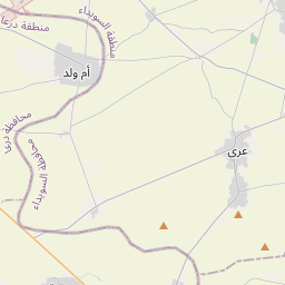
Ira (Arabic: عرى; also spelled Areh, ′Ara, Era or Ora) is a village in southeastern Syria, administratively part of the Suwayda District of the Suwayda Governorate, located south of Suwayda. According to the 2004 census, it had a population of 6,136.
En el mapa
En Wikipedia
Texto en inglés Aún no hay artículo en tu idioma: extracto en inglés.
Ira (Arabic: عرى; also spelled Areh, ′Ara, Era or Ora) is a village in southeastern Syria, administratively part of the Suwayda District of the Suwayda Governorate, located south of Suwayda. According to the 2004 census, it had a population of 6,136. Its inhabitants are predominantly Druze, with a Christian and Sunni Muslim Bedouin minorities. It is one of the villages of the Jabal al-Druze region. In 1596 the village appeared under the name of "Timri" in the Ottoman tax registers as part of the nahiya (subdistrict) of Bani Nasiyya in the Qadaa of Hauran. It had a Muslim population consisting of twenty-five households and fourteen bachelors, and a Christian population of five households. They paid a fixed tax-rate of 40% on agricultural products, including wheat, barley, summer crops, goats and beehives, in addition to occasional revenues; the taxes totaled 16,000 akçe. In 1838 'Ira was reported to be populated with Druze and Antiochian Greek Christians. 'Ira was resettled by Druze migrants in the early 19th century. It was controlled by the Al Hamdan family, who used it as a secondary headquarters. The Al Hamdan were ousted from 'Ira in 1857 by Ismail al-Atrash.
Texto: Wikipedia en inglés, CC BY-SA 4.0. ·