
Kabir Kouh
Mountain in Ilam Province, Iran
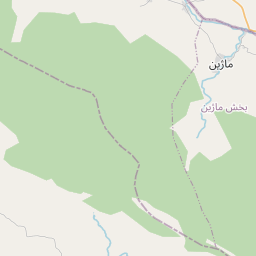
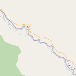
Kabir Kuh (Persian: کبیرکوه; Kurdish: کڤەر -Kiver) is one of the long ranges of the Zagros Mountains near the border of Lurestan and Ilam provinces in Ilam province, Iran. Covering an area of 9,500 km2 (3,700 sq mi), Kabir Kuh stretches 175 km (109 mi) in length and 48–80 km (30–50 mi) in width along the Zagros Mountains in the northwest–southeast direction.
Nº Q3191663 ★★★
Rara · Lugares
Kabir Kouh
Mountain in Ilam Province, Iran
Kabir Kuh (Persian: کبیرکوه; Kurdish: کڤەر -Kiver) is one of the long ranges of the Zagros Mountains near the border of Lurestan and Ilam provinces in Ilam province, Iran. Covering an area of 9,500 km2 (3,700 sq mi), Kabir Kuh stretches 175 km (109 mi) in length and 48–80 km (30–50 mi) in width along the Zagros Mountains in the northwest–southeast direction.
En el mapa
Último precio
—
Precio mínimo
—
Mediana 7 d
—
Ventas 30 d
0
Rango 30 d
—
En circulación
0
Cotización
mediana
mín – máx
ventas
Sin ventas en el periodo
Ver tabla
| Fecha | mediana | Mín | Máx | ventas |
|---|
Historial de ventas
- Última venta
- —
- Media 30 d
- —
- Mínimo 30 d
- —
- Máximo 30 d
- —
- Ventas 7 d
- 0
- Ventas 30 d
- 0
Aún no hay ventas.
Ventas anónimas: sin comprador ni vendedor. Las cifras solo cuentan ventas entre jugadores.
En Wikipedia
Texto en inglés Aún no hay artículo en tu idioma: extracto en inglés.
Kabir Kuh (Persian: کبیرکوه; Kurdish: کڤەر -Kiver) is one of the long ranges of the Zagros Mountains near the border of Lurestan and Ilam provinces in Ilam province, Iran. Covering an area of 9,500 km2 (3,700 sq mi), Kabir Kuh stretches 175 km (109 mi) in length and 48–80 km (30–50 mi) in width along the Zagros Mountains in the northwest–southeast direction. It begins about 20 km (12 mi) south of Ilam and stretches down to the vicinity of Andimeshk in Khuzestan. Made mainly by Cretaceous sedimentary rocks, the Kabir Kuh range consists of a large number of mountains, including Shah Ahmad, Tabriz, Kaleh-bad, Filman, Damaghey-e Anar, Rivasan, Puneh, Sabzkhani, Zarrin, Golgol that are covered by snow and ice all year round. Its highest peak is Kan Seifi with 2,790 m (9,150 ft) elevation, 50 km (31 mi) south-east of Ilam. Kabir Kuh runs along the Seymareh River, which becomes Karkheh when joins the Kashkan river before reaching the border of Ilam province and Khuzestan province. Kabir Kuh divides the mountainous region in western Iran into two regions generally referred as Piškuh (eastern side) and Poštkuh (western side), the latter virtually coinciding with Ilam. In prehistoric times, one of the largest known landslides occurred on the north-eastern slope of Kabir Kouh, moving across the Seymareh River. The eastern side is dominated by steep slopes where water and wooded valleys abound. The western side is, however, quite dry but rich in oil reservoirs and underground resources.
Texto: Wikipedia en inglés, CC BY-SA 4.0. · Imagen: User:Milad2017 (CC BY-SA 3.0) ·
Cartas cercanas

Kabir Kouh Tunnel
Road tunnel in Iran
Nº Q65049911 ★★★

Kahar (mountain)
Mountain in Iran
Nº Q26855628 ★★

Ilam
City in Ilam Province, Iran
Nº Q499470 ★

Zagros
Cadena montañosa de Irán
Nº Q167021 ★★★
Birk Mountain
Mountain in Iran
Nº Q20109809 ★★

Kuh-e Shah
Mountain in Kerman Province, Iran
Nº Q26883375 ★★★