
Kandovan, Osku
Village in Osku County, Iran
Kandovan (Persian: كندوان) is a village in Sahand Rural District of the Central District in Osku County, East Azerbaijan province, Iran. It is situated in the foothills of Mount Sahand, near the city of Osku. The village exemplifies manmade cliff dwellings which are still inhabited.
Nº Q1818028 ★
Común · Lugares
Kandovan, Osku
Village in Osku County, Iran
Kandovan (Persian: كندوان) is a village in Sahand Rural District of the Central District in Osku County, East Azerbaijan province, Iran. It is situated in the foothills of Mount Sahand, near the city of Osku. The village exemplifies manmade cliff dwellings which are still inhabited.
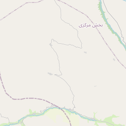
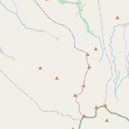
En el mapa
Último precio
—
Precio mínimo
—
Mediana 7 d
—
Ventas 30 d
0
Rango 30 d
—
En circulación
0
Cotización
mediana
mín – máx
ventas
Sin ventas en el periodo
Ver tabla
| Fecha | mediana | Mín | Máx | ventas |
|---|
Historial de ventas
- Última venta
- —
- Media 30 d
- —
- Mínimo 30 d
- —
- Máximo 30 d
- —
- Ventas 7 d
- 0
- Ventas 30 d
- 0
Aún no hay ventas.
Ventas anónimas: sin comprador ni vendedor. Las cifras solo cuentan ventas entre jugadores.
En Wikipedia
Texto en inglés Aún no hay artículo en tu idioma: extracto en inglés.
Kandovan (Persian: كندوان) is a village in Sahand Rural District of the Central District in Osku County, East Azerbaijan province, Iran. It is situated in the foothills of Mount Sahand, near the city of Osku. The village exemplifies manmade cliff dwellings which are still inhabited. The troglodyte homes, excavated inside volcanic rocks similar to dwellings in the Turkish region of Cappadocia, are locally called karaan. Karaans were cut into non-welded ignimbrites, also called "ash-flow tuffs," of Mount Sahand. The cone form of the houses is the result of the erosion of ignimbrite layers consisting of porous, round and angular pumice together with other volcanic particles that were positioned in a grey, acidic matrix. During the eruption of Sahand, pyroclastic flows formed the rocks of Kandovan. Around the village the thickness of this formation exceeds 100 metres (330 ft) and with time, due to water erosion, the cone-shaped cliffs were formed. Various grooves that were actually natural water passages have separated the cone-cliffs from each other and form the current streets of the village. Over some of these streets, bridges have been built that connect two karaans to each other. The karaans are developed in east–west direction and are mostly concentrated on the eastern side, whilst most entries and living units have a southward direction. Some karaans are as high as 30 to 40 m.
Texto: Wikipedia en inglés, CC BY-SA 4.0. · Imagen: Rəcəb Yaxşı (CC BY-SA 4.0) ·
Cartas cercanas

Osku County
County in East Azerbaijan Province, Iran
Nº Q1291748 ★★★★

Kandolus
Village in Nowshahr County, Iran
Nº Q5738031 ★★★★
Sahand, Iran
City in East Azerbaijan Province, Iran
Nº Q4358682 ★★★★
Kakavand (tribe)
Kurdish tribe in Iran and Iraq
Nº Q6349308 ★★★★
Liqvan
Village in Iran
Nº Q6557555 ★★★★

Kandovan Tunnel
Tunnel in Alborz and Mazandaran Province, Iran
Nº Q5897408 ★★★★★