

Kondelwald
Forest, about 2,500 hectares in area and up to 477.5 m above sea level, that forms part of the Moselle Eifel
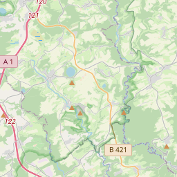
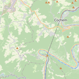
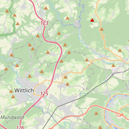
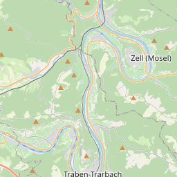
The Kondelwald, also known as the Kondel, is a forest, about 2,500 hectares in area and up to 477.5 m above sea level (NHN), that forms part of the Moselle Eifel. It lies within the counties of Bernkastel-Wittlich and Cochem-Zell in the German state of Rhineland-Palatinate.
Nº Q1781173 ★
Común · Lugares
Kondelwald
Forest, about 2,500 hectares in area and up to 477.5 m above sea level, that forms part of the Moselle Eifel
The Kondelwald, also known as the Kondel, is a forest, about 2,500 hectares in area and up to 477.5 m above sea level (NHN), that forms part of the Moselle Eifel. It lies within the counties of Bernkastel-Wittlich and Cochem-Zell in the German state of Rhineland-Palatinate.
En el mapa
En Wikipedia
Texto en inglés Aún no hay artículo en tu idioma: extracto en inglés.
The Kondelwald, also known as the Kondel, is a forest, about 2,500 hectares in area and up to 477.5 m above sea level (NHN), that forms part of the Moselle Eifel. It lies within the counties of Bernkastel-Wittlich and Cochem-Zell in the German state of Rhineland-Palatinate. It used to belong to the imperial Carolingian estate of Kröver Reich.
Texto: Wikipedia en inglés, CC BY-SA 4.0. ·
Cartas cercanas
-
M
Meulenwald
Forest area in Germany
Nº Q1752413 ★
Sin ofertas
-

Moselle Hills
Mountains in Germany
Nº Q1949074 ★
Sin ofertas
-

Klever Reichswald
Forest in Kleve district, Germany
Nº Q870039 ★★
Sin ofertas
-

Moselle Eifel
Mountain range
Nº Q1330074 ★
Sin ofertas
-

Lower Westerwald
Geographic region in Rhineland-Palatinate, Germany
Nº Q1794875 ★
Sin ofertas
-

Bosque de Grunewald
Nº Q11705528 ★★
Sin ofertas