
Lake Wolayer
Lake in the Carnic Alps in Carinthia
The Lake Wolayer is an Austrian mountain lake on the Carinthian side of the Carnic Main Ridge, near the Plöcken Pass. It is the centrepiece of the Wolayer See and surrounding area nature reserve.
Nº Q2588364 ★★★
Rara · Lugares
Lake Wolayer
Lake in the Carnic Alps in Carinthia
The Lake Wolayer is an Austrian mountain lake on the Carinthian side of the Carnic Main Ridge, near the Plöcken Pass. It is the centrepiece of the Wolayer See and surrounding area nature reserve.
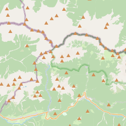
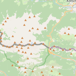
En el mapa
Último precio
—
Precio mínimo
—
Mediana 7 d
—
Ventas 30 d
0
Rango 30 d
—
En circulación
0
Cotización
mediana
mín – máx
ventas
Sin ventas en el periodo
Ver tabla
| Fecha | mediana | Mín | Máx | ventas |
|---|
Historial de ventas
- Última venta
- —
- Media 30 d
- —
- Mínimo 30 d
- —
- Máximo 30 d
- —
- Ventas 7 d
- 0
- Ventas 30 d
- 0
Aún no hay ventas.
Ventas anónimas: sin comprador ni vendedor. Las cifras solo cuentan ventas entre jugadores.
En Wikipedia
Texto en inglés Aún no hay artículo en tu idioma: extracto en inglés.
The Lake Wolayer is an Austrian mountain lake on the Carinthian side of the Carnic Main Ridge, near the Plöcken Pass. It is the centrepiece of the Wolayer See and surrounding area nature reserve. Notable plant species include Alpine eryngo (Eryngium alpestre), sweet cicely (Myrrhis odorata), and Austrian ribwort (Pleurospermum austriacum). The lake lies at an altitude of 1,951 m (6,401 ft) above sea level and covers an area of 4 hectares. It is located in a doline formed tectonically and reshaped by the Wolayer Glacier during the Ice Age. The catchment area spans approximately 60 ha (150 acres). Annual rainfall in the region ranges between 2,000 and 2,500 mm (79 and 98 in), maintaining a relatively constant water level despite the absence of surface inflow. The lakebed is covered with mud, which seals the lake. The western part of the lake slopes gently, while the eastern side is steeper. The deepest point is 13.9 m (46 ft) below the surface, but two-thirds of the lake is less than 5 m (16 ft) deep. Water that flows underground from the lake feeds two springs: one in Austrian territory and another in Italian territory, south of the Lambertenghi hut.
Texto: Wikipedia en inglés, CC BY-SA 4.0. · Imagen: GeKo15 (CC BY-SA 3.0 at) ·


