

Poco común · Lugares
Pyoktong County
County of North Korea
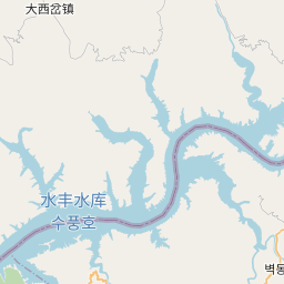
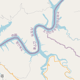
Pyŏktong County is a kun, or county, in northern North P'yŏngan province, North Korea. It lies in the valley of the Yalu River, and borders China to the north. Within North Korea, it is bounded by Tongch'ang to the south, Ch'angsŏng to the west, and Usi county in Chagang province to the east.
En el mapa


En Wikipedia
Texto en inglés Aún no hay artículo en tu idioma: extracto en inglés.
Pyŏktong County is a kun, or county, in northern North P'yŏngan province, North Korea. It lies in the valley of the Yalu River, and borders China to the north. Within North Korea, it is bounded by Tongch'ang to the south, Ch'angsŏng to the west, and Usi county in Chagang province to the east. It was separated from Usi in 1952, as part of a nationwide reorganization of local government. The terrain is steep and mountainous, with the Kangnam and Pinandŏk ranges both passing through the county. The highest point is Piraebong, at 1470 metres. There are various small streams, including the Tongch'ŏn (동천), Songgyech'ŏn (송계천), and Namch'ŏn (남천). These are used to transport cut lumber; and the Namch'ŏn is also used to generate hydroelectric power. Due to the rugged terrain, only seven percent of Pyoktong's area is cultivated, while 80% is forested. Pyŏktong county is divided into 1 ŭp (town) and 19 ri (villages): The average year-round temperature is 7.1 °C, plunging to a mean of -12.5 °C in January and rising to 23 °C in August.
Texto: Wikipedia en inglés, CC BY-SA 4.0. · Imagen: Geoarchive and OpenStreetMap contributors (CC BY-SA 4.0) ·