
Thuringian Basin
Landscape in Thuringia, Germany
The Thuringian Basin (German: Thüringer Becken, pronounced [ˈtyːʁɪŋɐ ˈbɛkn̩]) is a depression in the central and northwest part of Thuringia in Germany which is crossed by several rivers, the longest of which is the Unstrut. It stretches about 60 kilometres (37 mi) from north to south and around 120 kilometres (75 mi) from east to west.
Nº Q567318 ★★★
Rara · Lugares
Thuringian Basin
Landscape in Thuringia, Germany
The Thuringian Basin (German: Thüringer Becken, pronounced [ˈtyːʁɪŋɐ ˈbɛkn̩]) is a depression in the central and northwest part of Thuringia in Germany which is crossed by several rivers, the longest of which is the Unstrut. It stretches about 60 kilometres (37 mi) from north to south and around 120 kilometres (75 mi) from east to west.
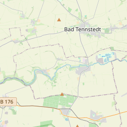
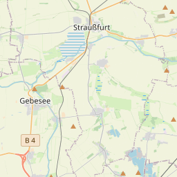
En el mapa
Último precio
—
Precio mínimo
—
Mediana 7 d
—
Ventas 30 d
0
Rango 30 d
—
En circulación
0
Cotización
mediana
mín – máx
ventas
Sin ventas en el periodo
Ver tabla
| Fecha | mediana | Mín | Máx | ventas |
|---|
Historial de ventas
- Última venta
- —
- Media 30 d
- —
- Mínimo 30 d
- —
- Máximo 30 d
- —
- Ventas 7 d
- 0
- Ventas 30 d
- 0
Aún no hay ventas.
Ventas anónimas: sin comprador ni vendedor. Las cifras solo cuentan ventas entre jugadores.
En Wikipedia
Texto en inglés Aún no hay artículo en tu idioma: extracto en inglés.
The Thuringian Basin (German: Thüringer Becken, pronounced [ˈtyːʁɪŋɐ ˈbɛkn̩]) is a depression in the central and northwest part of Thuringia in Germany which is crossed by several rivers, the longest of which is the Unstrut. It stretches about 60 kilometres (37 mi) from north to south and around 120 kilometres (75 mi) from east to west. Its height varies from about 150 to 250 m above sea level (NN). The Basin is surrounded by a wide outer girdle of limestone (Muschelkalk) ridges (including Hainich, Dün, Hainleite, Hohe Schrecke, Schmücke, Finne), and to the southwest by the Thuringian Forest and to the southeast by sharply divided terraces (the Ilm-Saale and Ohrdruf Muschelkalk plateaus, and the Saale-Elster Bunter sandstone plateau). The Thuringian Basin belongs to the triassic period, during which horizontal beds of Bunter sandstone, Muschelkalk and Keuper were laid down. Below those lie the salt and gypsum layers of Magnesian Limestone (Zechstein). In the Cenozoic era the surrounding ridges were uplifted, whilst the Thuringian Basin sank to form a saucer-shaped depression. The elevation of the Thuringian Basin descends from the south and west to the east. While some of the marginal ridges have the character of low mountain ranges, there are no really noteworthy uplands within it, apart from the Ettersberg and Fahnerscher Höhe. The Thuringian Basin is dominated by agriculture. Along with the Magdeburg Börde and Leipzig Bay it is one of the richest arable lands in Germany. It was settled in the 8th and 9th century which makes most of the villages and towns in the basin well over 1000 years old. As a result of the fertile countryside, large cities were established very early on in the Basin and on its perimeter (Erfurt and the free imperial city of Mühlhausen). Other towns in the Thuringian Basin are (year...
Texto: Wikipedia en inglés, CC BY-SA 4.0. · Imagen: Elop Abgeleitet von File:Flussgebietskarte Deutschland.png (... (CC BY 3.0) ·
Cartas cercanas

Prusia Real
Estado histórico
Nº Q589662 ★★★

Provincia de Papúa
Provincia de Indonesia
Nº Q5095 ★★★

Redditch
Ciudad de Inglaterra, Reino Unido
Nº Q865716 ★★★

Ave María (Florida)
Ciudad universitaria
Nº Q790314 ★★★

Bhandardara
Village in Maharashtra, India
Nº Q281031 ★★★

Kanada
Warehouses in the Auschwitz concentration camp, occupied Poland, that stored looted prisoners' property
Nº Q1723436 ★★★