
Wangenitzsee
Lake in Spittal an der Drau District, Carinthia, Austria
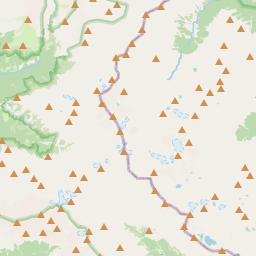
The Wangenitzsee is an alpine lake in Carinthia, Austria. It is located in the Schober group of Hohe Tauern National Park, and is at an altitude of 2,465 metres (8,087 ft) above sea level (AA). The lake lies south-east from the Hoher Perschitzkopf, just some 100 meters away from the border to East Tyrol.
Nº Q1321632 ★★
Poco común · Lugares
Wangenitzsee
Lake in Spittal an der Drau District, Carinthia, Austria
The Wangenitzsee is an alpine lake in Carinthia, Austria. It is located in the Schober group of Hohe Tauern National Park, and is at an altitude of 2,465 metres (8,087 ft) above sea level (AA). The lake lies south-east from the Hoher Perschitzkopf, just some 100 meters away from the border to East Tyrol.
En el mapa
Último precio
—
Precio mínimo
—
Mediana 7 d
—
Ventas 30 d
0
Rango 30 d
—
En circulación
0
Cotización
mediana
mín – máx
ventas
Sin ventas en el periodo
Ver tabla
| Fecha | mediana | Mín | Máx | ventas |
|---|
Historial de ventas
- Última venta
- —
- Media 30 d
- —
- Mínimo 30 d
- —
- Máximo 30 d
- —
- Ventas 7 d
- 0
- Ventas 30 d
- 0
Aún no hay ventas.
Ventas anónimas: sin comprador ni vendedor. Las cifras solo cuentan ventas entre jugadores.
En Wikipedia
Texto en inglés Aún no hay artículo en tu idioma: extracto en inglés.
The Wangenitzsee is an alpine lake in Carinthia, Austria. It is located in the Schober group of Hohe Tauern National Park, and is at an altitude of 2,465 metres (8,087 ft) above sea level (AA). The lake lies south-east from the Hoher Perschitzkopf, just some 100 meters away from the border to East Tyrol. On its north bank lies the Wangenitzsee Hut, meaning that the lake is on the Wiener Höhenweg. The lake has an area of 21.57 hectares (53.3 acres). It has a maximum depth of 48 metres (157 ft), with an average depth of 16.2 metres (53 ft). The shoreline is 2 kilometres (1.2 mi) long, and the volume of the lake is 3,487,000,000 cubic metres (9.21×10¹¹ US gal). In the southwestern part of the lake lie three small islands. The catchment area of the lake is relatively small, at 1.94 square kilometres (0.75 mi2). The main inflow of the lake is the Kreuzsee, which is drained via the Wangenitzbach into the Möll. The flora in the area around the lake consists primarily of Carex curvula and Scheuchzer's cottongrass.
Texto: Wikipedia en inglés, CC BY-SA 4.0. · Imagen: Christian Pellegrin from Friuli, Italy (CC BY-SA 2.0) ·
Cartas cercanas
-

Wangenitzsee Hut
Mountain hut in the Schober group in Carinthia
Nº Q2548328 ★
Sin ofertas
-

Stappitzer See
Lake in Carinthia
Nº Q2332152 ★
Sin ofertas
-

Brennsee
Lake in Carinthia, Austria
Nº Q909524 ★★
Sin ofertas
-

Dösener See
Lago
Nº Q1271513 ★
Sin ofertas
-

Hafnersee
Lake in Carinthia, Austria
Nº Q1568116 ★★
Sin ofertas
-

Petzeck
Mountain in the Schober Group in Carinthia
Nº Q387629 ★★
Sin ofertas