
Buraca
Freguesia du Portugal
Buraca (Portuguese pronunciation: [buˈɾakɐ]) is a former civil parish, located in the municipality of Amadora, Portugal. In 2013, the parish merged into the new parish of Águas Livres. As of the 2011 Census, it had a population of 15 892.
Nº Q1010176 ★★
Peu commune · Lieux
Buraca
Freguesia du Portugal
Buraca (Portuguese pronunciation: [buˈɾakɐ]) is a former civil parish, located in the municipality of Amadora, Portugal. In 2013, the parish merged into the new parish of Águas Livres. As of the 2011 Census, it had a population of 15 892.
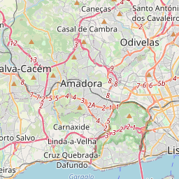
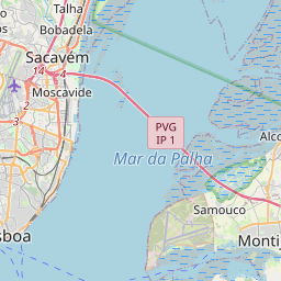
Sur la carte
Dernier prix
—
Prix plancher
—
Médiane 7 j
—
Ventes 30 j
0
Fourchette 30 j
—
En circulation
0
Cours
médiane
min – max
ventes
Aucune vente sur la période
Voir le tableau
| Date | médiane | Min | Max | ventes |
|---|
Historique des ventes
- Dernière vente
- —
- Moyenne 30 j
- —
- Plus bas 30 j
- —
- Plus haut 30 j
- —
- Ventes 7 j
- 0
- Ventes 30 j
- 0
Aucune vente pour l'instant.
Ventes anonymes : ni acheteur ni vendeur. Les chiffres ne comptent que les ventes entre joueurs.
Sur Wikipédia
Texte en anglais Pas encore d'article dans ta langue : extrait en anglais.
Buraca (Portuguese pronunciation: [buˈɾakɐ]) is a former civil parish, located in the municipality of Amadora, Portugal. In 2013, the parish merged into the new parish of Águas Livres. As of the 2011 Census, it had a population of 15 892. It had an area of 1.66 square kilometers. The southern area of the parish included the first Decathlon store in Portugal, integrated in the main shopping areas of the Lisbon metropolitan area. This shopping area also extends to the parishes of Alfragide and Carnaxide. Its patron saint is Our Lady Mother of God. Buraca also had Rádio Renascença; owned by Church which was held and destroyed during the Portugal revolution and aftermath in 1974 and 1975. Before the dissolution of the parish, its area was also the location of the headquarters of the Laboratório Nacional de Energia e Geologia (LNEG) and the Directorate-General Environment (DGA).
Texte : Wikipédia en anglais, CC BY-SA 4.0. · Image : CorreiaPM (Public domain) ·
Cartes voisines

Damaia
Freguesia du Portugal
Nº Q377919 ★★

Reboleira
Freguesia du Portugal
Nº Q928716 ★★★

Santo Amador
Ancienne freguesia du Portugal
Nº Q1019721 ★★

Arouca (freguesia)
Ancienne freguesia du Portugal
Nº Q1946349 ★★★

Amadora
Municipalité du Portugal
Nº Q189166 ★★★★★

Freguesia de São Brás
Ancienne freguesia du Portugal
Nº Q1024772 ★★