
Dedo de Dios
Mountain in Spain
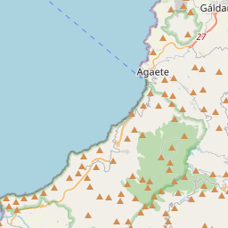
El Dedo de Dios (translated: God's finger) is a 30 m (98 ft) high sea stack in the Atlantic Ocean, off the northern part of Gran Canaria, one of the Canary Islands. During Tropical Storm Delta in November 2005, the thin top of this geological formation broke off and fell into the sea.
Nº Q1182225 ★★★
Rare · Lieux
Dedo de Dios
Mountain in Spain
El Dedo de Dios (translated: God's finger) is a 30 m (98 ft) high sea stack in the Atlantic Ocean, off the northern part of Gran Canaria, one of the Canary Islands. During Tropical Storm Delta in November 2005, the thin top of this geological formation broke off and fell into the sea.
Sur la carte
Dernier prix
—
Prix plancher
—
Médiane 7 j
—
Ventes 30 j
0
Fourchette 30 j
—
En circulation
0
Cours
médiane
min – max
ventes
Aucune vente sur la période
Voir le tableau
| Date | médiane | Min | Max | ventes |
|---|
Historique des ventes
- Dernière vente
- —
- Moyenne 30 j
- —
- Plus bas 30 j
- —
- Plus haut 30 j
- —
- Ventes 7 j
- 0
- Ventes 30 j
- 0
Aucune vente pour l'instant.
Ventes anonymes : ni acheteur ni vendeur. Les chiffres ne comptent que les ventes entre joueurs.
Sur Wikipédia
Texte en anglais Pas encore d'article dans ta langue : extrait en anglais.
El Dedo de Dios (translated: God's finger) is a 30 m (98 ft) high sea stack in the Atlantic Ocean, off the northern part of Gran Canaria, one of the Canary Islands. During Tropical Storm Delta in November 2005, the thin top of this geological formation broke off and fell into the sea. It is one of the many natural monuments outside the coastal town of Agaete on Gran Canaria. The peculiarly shaped rock has been an inspiration to many artists, and it is believed that the author Domingo Doreste was the first to name it God's finger. Geologically, the area is the oldest on Gran Canaria, having started to form around 14 million years ago. Over a period of 200–300,000 years, the oddly shaped monument was created from the basaltic materials in the area.
Texte : Wikipédia en anglais, CC BY-SA 4.0. · Image : LBM1948 (CC BY-SA 4.0) ·
Cartes voisines

Los Gigantes
Établissement humain en Espagne
Nº Q1489481 ★★★

Mont Tindaya
Montagne espagnole
Nº Q2878015 ★★★
Teide Trophy
Football Competition
Nº Q9090279 ★★

Floridablanca (Santander)
Municipalité colombienne dans le département de Santander
Nº Q1006661 ★★★

Pico Viejo
Montagne espagnole
Nº Q2092383 ★★

Telde
Commune espagnole
Nº Q55845 ★★★★