
Guadalmina
River in Spain
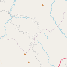
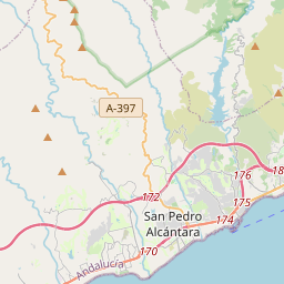
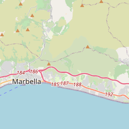
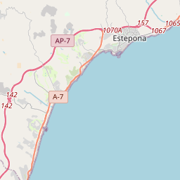
The river Guadalmina (from the Arabic for "Wadi (river) of the port") is a short coastal river of the Mediterranean basin in southern Spain that runs entirely within the Andalusian province of Málaga. Only 28 kilometres (17 mi) in length, the Guadalmina rises in the Sierra Bermeja, in the municipality of Igualeja, but its main course begins below the mountains in the municipality of Benahavís, forming a karst aquifer in an area known as Las Angosturas (the narrows).
Nº Q1552583 ★★
Peu commune · Lieux
Guadalmina
River in Spain
The river Guadalmina (from the Arabic for "Wadi (river) of the port") is a short coastal river of the Mediterranean basin in southern Spain that runs entirely within the Andalusian province of Málaga. Only 28 kilometres (17 mi) in length, the Guadalmina rises in the Sierra Bermeja, in the municipality of Igualeja, but its main course begins below the mountains in the municipality of Benahavís, forming a karst aquifer in an area known as Las Angosturas (the narrows).
Sur la carte

Dernier prix
—
Prix plancher
—
Médiane 7 j
—
Ventes 30 j
0
Fourchette 30 j
—
En circulation
0
Cours
médiane
min – max
ventes
Aucune vente sur la période
Voir le tableau
| Date | médiane | Min | Max | ventes |
|---|
Historique des ventes
- Dernière vente
- —
- Moyenne 30 j
- —
- Plus bas 30 j
- —
- Plus haut 30 j
- —
- Ventes 7 j
- 0
- Ventes 30 j
- 0
Aucune vente pour l'instant.
Ventes anonymes : ni acheteur ni vendeur. Les chiffres ne comptent que les ventes entre joueurs.
Sur Wikipédia
Texte en anglais Pas encore d'article dans ta langue : extrait en anglais.
The river Guadalmina (from the Arabic for "Wadi (river) of the port") is a short coastal river of the Mediterranean basin in southern Spain that runs entirely within the Andalusian province of Málaga. Only 28 kilometres (17 mi) in length, the Guadalmina rises in the Sierra Bermeja, in the municipality of Igualeja, but its main course begins below the mountains in the municipality of Benahavís, forming a karst aquifer in an area known as Las Angosturas (the narrows). The river flows into the municipality of Marbella near San Pedro de Alcántara, and serves to delimit its border from that of the municipality of Estepona. The Guadalmina was formerly of defensive strategic importance for the people of Marbella; its waters also served to power watermills for grinding grain into flour. The La Concepción reservoir is the primary water source for this municipality; it is formed by a diversion dam on the Río Verde, where the waters of the rivers Guadalmina, Guadalmansa and Guadaiza join and are captured, then transported to provide the water supply of the Costa del Sol towns of Benalmadena, Fuengirola, Mijas, Benahavís, Marbella, Casares and Manilva. The lower course of the river is heavily urbanized; many homes there have a high risk of inundation. Near the river's mouth, next to San Pedro de Alcántara, are the important archaeological sites of the early 4th-century Christian church Basílica de Vega del Mar, the 3rd-century vaulted Roman baths of Las Bóvedas (the Domes) and the eponymous watch tower of Torre de Las Bóvedas.
Texte : Wikipédia en anglais, CC BY-SA 4.0. · Image : Hans G. Oberlack (CC BY-SA 3.0) ·
Cartes voisines

Alhaurín de la Torre
Commune espagnole
Nº Q976528 ★★★★

Benahavís
Commune espagnole
Nº Q816672 ★★★★

Alberche
Cours d'eau espagnol
Nº Q16513 ★★★

Tormes
Rivière affluente du Douro, dans les provinces d'Ávila, Salamanque et Zamora, Castille-et-León, Espagne
Nº Q14755 ★★★

Bérchules
Commune espagnole
Nº Q554275 ★★★

Mijares
Cours d'eau espagnol
Nº Q20142 ★★★