
Gundlupet
Établissement humain en Inde
Gundlupet (Gundlupētē in Kannada) is a municipal town situated in the Chamarajanagar district of Karnataka, India. It is also known as "The flower pot of India". It is situated on NH 766, 60 km away from Mysuru and approximately 200 km from the state administrative capital, Bengaluru.
Nº Q1708600 ★★
Peu commune · Lieux
Gundlupet
Établissement humain en Inde
Gundlupet (Gundlupētē in Kannada) is a municipal town situated in the Chamarajanagar district of Karnataka, India. It is also known as "The flower pot of India". It is situated on NH 766, 60 km away from Mysuru and approximately 200 km from the state administrative capital, Bengaluru.
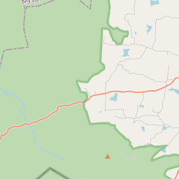
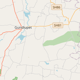
Sur la carte
Dernier prix
—
Prix plancher
—
Médiane 7 j
—
Ventes 30 j
0
Fourchette 30 j
—
En circulation
0
Cours
médiane
min – max
ventes
Aucune vente sur la période
Voir le tableau
| Date | médiane | Min | Max | ventes |
|---|
Historique des ventes
- Dernière vente
- —
- Moyenne 30 j
- —
- Plus bas 30 j
- —
- Plus haut 30 j
- —
- Ventes 7 j
- 0
- Ventes 30 j
- 0
Aucune vente pour l'instant.
Ventes anonymes : ni acheteur ni vendeur. Les chiffres ne comptent que les ventes entre joueurs.
Sur Wikipédia
Texte en anglais Pas encore d'article dans ta langue : extrait en anglais.
Gundlupet (Gundlupētē in Kannada) is a municipal town situated in the Chamarajanagar district of Karnataka, India. It is also known as "The flower pot of India". It is situated on NH 766, 60 km away from Mysuru and approximately 200 km from the state administrative capital, Bengaluru. Gundlupet is the last town in Karnataka on the National Highway 766 which goes through Mysore, Ooty, Wayanad, and Kozhikode. It is situated very close to the Tamil Nadu and Kerala state borders. NH 181 begins from Gundlupet and ends in Nagapattinam in Tamil Nadu via Ooty and Coimbatore. The Bandipur National Park is situated 17 km away from Gundlupet, giving the town the epithet also known as "Land of Tigers". Gundlupet was previously known as Vijayapura, named after the ancient Vijayanarayana Temple.
Texte : Wikipédia en anglais, CC BY-SA 4.0. · Image : Prof tpms (CC BY-SA 4.0) ·
Cartes voisines

Gopalaswamy Hills
Hill in the Gundlupete Taluk, Karnataka, India
Nº Q11924488 ★

Krishnarajapura
Établissement humain en Inde
Nº Q2241092 ★

Hospet
Ville de l'Inde
Nº Q33414 ★★

Nanjangud
Établissement humain en Inde
Nº Q2475042 ★★

Virajpet
Établissement humain en Inde
Nº Q2571884 ★★

District de Bijapur (Karnataka)
District de l'État indien du Karnataka
Nº Q83108 ★