

Peu commune · Lieux
Murghob District
District in Gorno-Badakhshan Autonomous Province
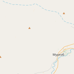
Murghob District (Tajik: Ноҳияи Мурғоб) is a district in Tajikistan, occupying the eastern two-thirds of the Gorno-Badakhshan Autonomous Region (GBAO). The area of Murghob District is 37,300 km2, covering 26 percent of Tajikistan's soil, but only 0.17% of its population.
Sur la carte
Sur Wikipédia
Texte en anglais Pas encore d'article dans ta langue : extrait en anglais.
Murghob District (Tajik: Ноҳияи Мурғоб) is a district in Tajikistan, occupying the eastern two-thirds of the Gorno-Badakhshan Autonomous Region (GBAO). The area of Murghob District is 37,300 km, covering 26 percent of Tajikistan's soil, but only 0.17% of its population. Murghob District borders on Kyrgyzstan to the north, China to the east, and Afghanistan to the south. The population of Murghob District is 15,900 (1 January 2020 estimate). Its administrative capital is the village Murghob (also known as Murghab). The estimated population of the district is around 15,900 as of 2020. According to 2015 data, the majority of the population are Kyrgyz (around 80%) while a minority are Pamiris (estimated at 20% of the population). The district is divided administratively into six jamoats. They are as follows: It borders Afghanistan to the south, China's Xinjiang region to the east, and Kyrgyzstan to the north. Within Tajikistan it is bordered to the west by four other GBAO districts and the Region of Republican Subordination.
Texte : Wikipédia en anglais, CC BY-SA 4.0. · Image : Kondephy (CC BY-SA 4.0) ·