

Peu commune · Lieux
Swist
River in Germany
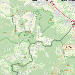
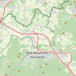
The Swist (German pronunciation: [svɪst] ) is a stream, 43.6 kilometres (27.1 mi) long, in the German Rhineland. It rises on the northern edge of the Eifel at 330 metres above sea level and empties from the right and southeast into the Rhine tributary, the Erft, between Weilerswist and Bliesheim (a district of Erftstadt).
Sur la carte
Sur Wikipédia
Texte en anglais Pas encore d'article dans ta langue : extrait en anglais.
The Swist (German pronunciation: [svɪst] ) is a stream, 43.6 kilometres (27.1 mi) long, in the German Rhineland. It rises on the northern edge of the Eifel at 330 metres above sea level and empties from the right and southeast into the Rhine tributary, the Erft, between Weilerswist and Bliesheim (a district of Erftstadt). Occasionally the Swist is also called the Swistbach, and locals often just call it der Bach ("the stream"). The Swist flows through the municipality Swisttal, the town of Meckenheim and Flerzheim. There are cycle paths by the side of the stream along this stretch. The Swist gave its name to Swisttal and the town of Weilerswist. Its source area is situated at the northern edge of the Eifel.
Texte : Wikipédia en anglais, CC BY-SA 4.0. · Image : AxelHH at de.wikipedia (Public domain) ·


