
West Seram Regency
Subdivision administrative de la province de Maluku, en Indonésie
West Seram Regency is a regency of Maluku, Indonesia. It is mainly located on Seram, but includes various islands lying to the west of Seram - the largest being Manipa, Kelang and Buano, as well as the smaller islets of Babi, Pua, Masowoi, and Marsegu.
Nº Q18942 ★★★★
Super rare · Lieux
West Seram Regency
Subdivision administrative de la province de Maluku, en Indonésie
West Seram Regency is a regency of Maluku, Indonesia. It is mainly located on Seram, but includes various islands lying to the west of Seram - the largest being Manipa, Kelang and Buano, as well as the smaller islets of Babi, Pua, Masowoi, and Marsegu.
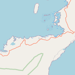
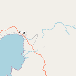
Sur la carte
Dernier prix
—
Prix plancher
—
Médiane 7 j
—
Ventes 30 j
0
Fourchette 30 j
—
En circulation
0
Cours
médiane
min – max
ventes
Aucune vente sur la période
Voir le tableau
| Date | médiane | Min | Max | ventes |
|---|
Historique des ventes
- Dernière vente
- —
- Moyenne 30 j
- —
- Plus bas 30 j
- —
- Plus haut 30 j
- —
- Ventes 7 j
- 0
- Ventes 30 j
- 0
Aucune vente pour l'instant.
Ventes anonymes : ni acheteur ni vendeur. Les chiffres ne comptent que les ventes entre joueurs.
Sur Wikipédia
Texte en anglais Pas encore d'article dans ta langue : extrait en anglais.
West Seram Regency is a regency of Maluku, Indonesia. It is mainly located on Seram, but includes various islands lying to the west of Seram - the largest being Manipa, Kelang and Buano, as well as the smaller islets of Babi, Pua, Masowoi, and Marsegu. It covers a land area of 5,014.24 km2, and had a population of 164,654 at the 2010 Census and 212,393 at the 2020 Census; the official estimate as at mid 2025 was 218,637 (comprising 109,683 males and 108,954 females). The principal town lies at Piru, a port at the northern coast of Latira Bay (Teluk Latira) which is a northwards extension of Piru Bay (Teluk Piru) and almost separates the Huamual Peninsula from the rest of Seram Island. The western sector of the Regency (the Huamual Peninsula and the islands off the west coast) occupies just under 25% of the land area, but held over 42.2% of the Regency's population in 2025.
Texte : Wikipédia en anglais, CC BY-SA 4.0. · Image : Вальдимар (CC BY-SA 3.0) ·
Cartes voisines

Seram Bagian oriental
Subdivision administrative d'Indonésie
Nº Q16569 ★★★★

Maluku central
Département indonésien
Nº Q4201768 ★★★★★

Bangka Barat
Kabupaten de la province de Bangka-Belitung
Nº Q8176 ★★★★

Kabupaten de Lima Puluh Kota
Kabupaten de la province indonésienne de Sumatra occidental
Nº Q6032 ★★★★★

Seluma
Kabupaten de la province de Bengkulu
Nº Q8037 ★★★★

Teluk Wondama
Département indonésien
Nº Q26827 ★★★★